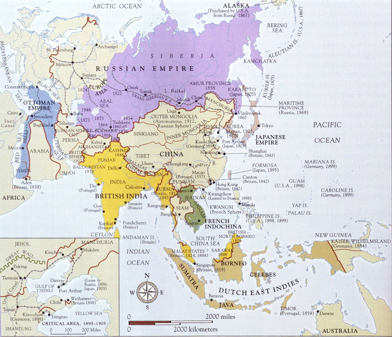
Lüshun and Dalian
In 1898, China leased Port Arthur and Dairen (Lüshun and Dalian) to Russia.
These ports, located in the Liaodong Peninsula in northeastern China, were of significant military and commercial value,
and were leased to Russia under the
Li-Lobanov Agreement.
Russia was granted a 25-year lease of the region, which allowed them to build a naval
base and railway infrastructure. This lease occurred after the
First Sino-Japanese War and was part of a broader
struggle for influence in Northeast China.
In 1905, after Japan's victory over Russia in the Russo-Japanese War,
the Treaty of Portsmouth forced China to lease these two ports to Japan.
Japan gained control over these areas for the same strategic and economic reasons, including the
establishment of a naval base and infrastructure.
Dalian / Dairen
The port city of Dairen (now Dalian) has a rich history as a strategic naval and commercial hub.
The name Dairen was used during the period when the city was under Japanese control, specifically from
1905 to 1945, when it was part of the Japanese-controlled Kwantung Leased Territory. During this time,
Japan developed Dairen into a major port and industrial center, using it as a base for their expansion in
Northeast Asia.
After World War II and the defeat of Japan, the city reverted to Chinese control and was renamed Dalian.