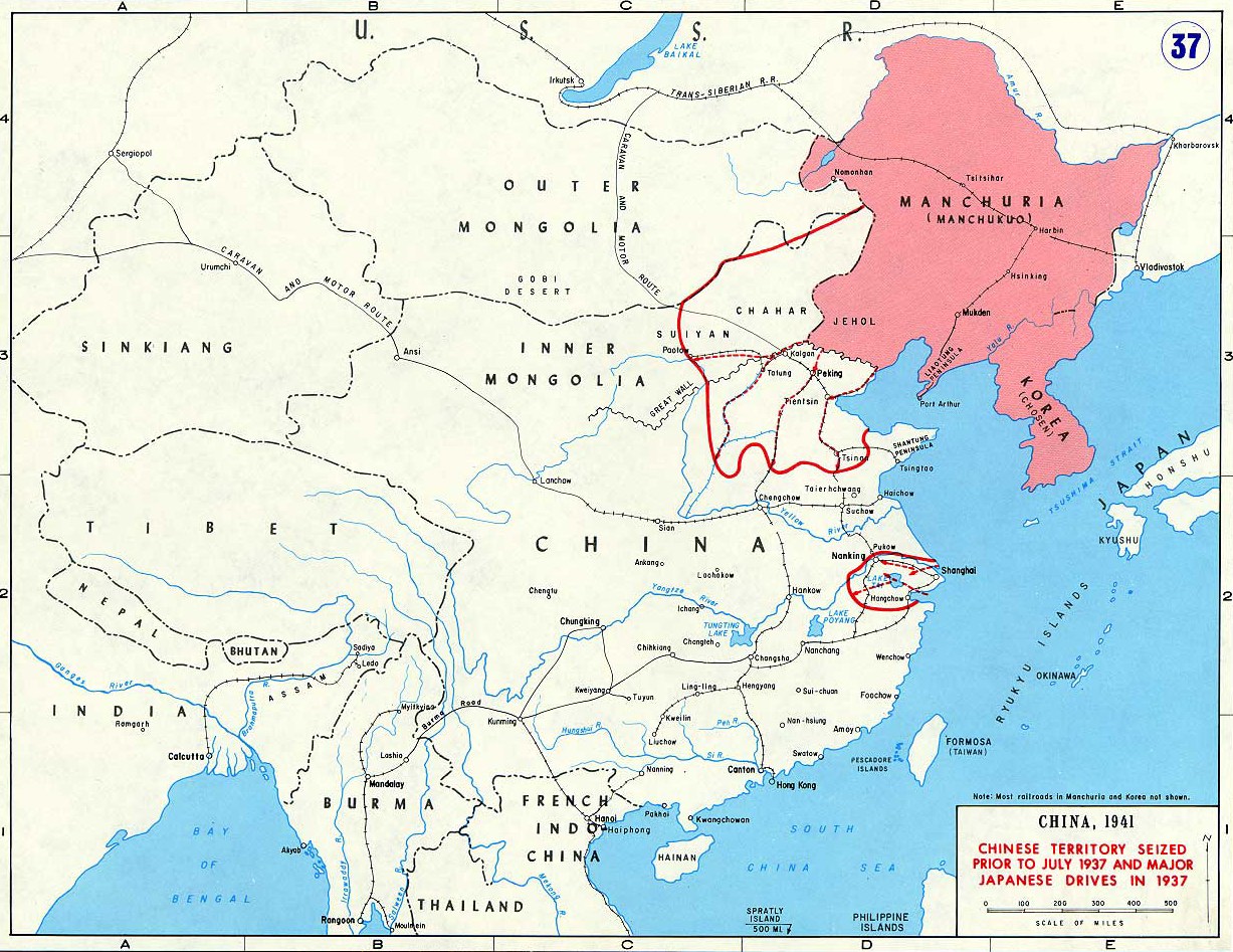
Map Description
History Map of China 1937
Featuring:
- Manchuria (Manchukuo, Manzhouguo)
- Korea (Chosen)
Illustrating
- Chinese Territory Seized Prior to July 1937
- Major Japanese Drives in 1937
This map illustrates both Japan's pre-World War II territorial acquisitions in East Asia (specifically areas seized before July 1937,
including Manchuria/Manchukuo which Japan took control of following
the 1931 Mukden Incident) and the initial military campaigns of
the Second Sino-Japanese War that began in July 1937
with the Marco Polo Bridge Incident.
This conflict, though often considered a precursor to or early phase of World War II in the Pacific, was technically a separate war
between China and Japan that had been underway for approximately four years before Japan's attack on Pearl Harbor in December 1941
brought the United States into World War II.
We're looking therefore at a crucial transitional period in East Asian history, as this map is showing both Japan's earlier imperial
expansionism and the beginning stages of what would eventually be absorbed into the broader global conflict.
The Second Sino-Japanese War was fought from July 7, 1937, to September 2, 1945 (when Japan formally surrendered), and hence
did overlap with World War II.
WWII officially started on September 1, 1939, when Germany invaded Poland, and ended on September 2, 1945, with Japan's surrender.
Credits
Courtesy of the United States Military Academy Department of History.
Related Links
About the Second Sino-Japanese WarAbout World War 2
WWII Timelines
Governments of China
Click map to see original size.
More History
