Map Description
Two History Maps of WWII: Southeast Asia 1941
-
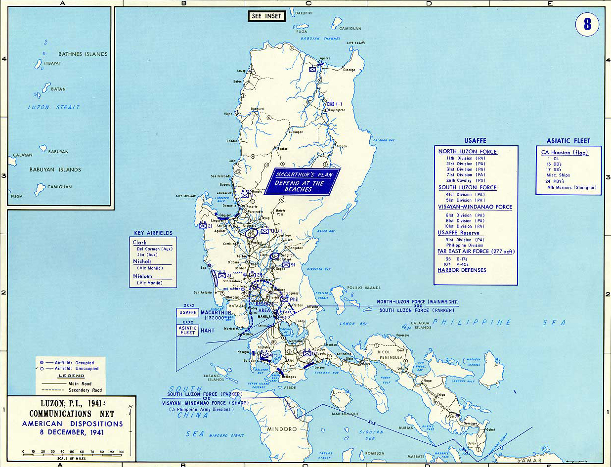
Luzon, Philippines
-
Inset: Luzon Strait
Featuring:
- Batanes Islands (Batan Islands) - approximately 162 kilometers (101 miles) north of the Luzon mainland
- Babuyan Islands - roughly 70–100 kilometers (43 to 62 miles) north of the Luzon mainland
- Batanes Islands (Batan Islands) - approximately 162 kilometers (101 miles) north of the Luzon mainland
Illustrating:
Map 1: Communications Net, American Dispositions, 8 December 1941
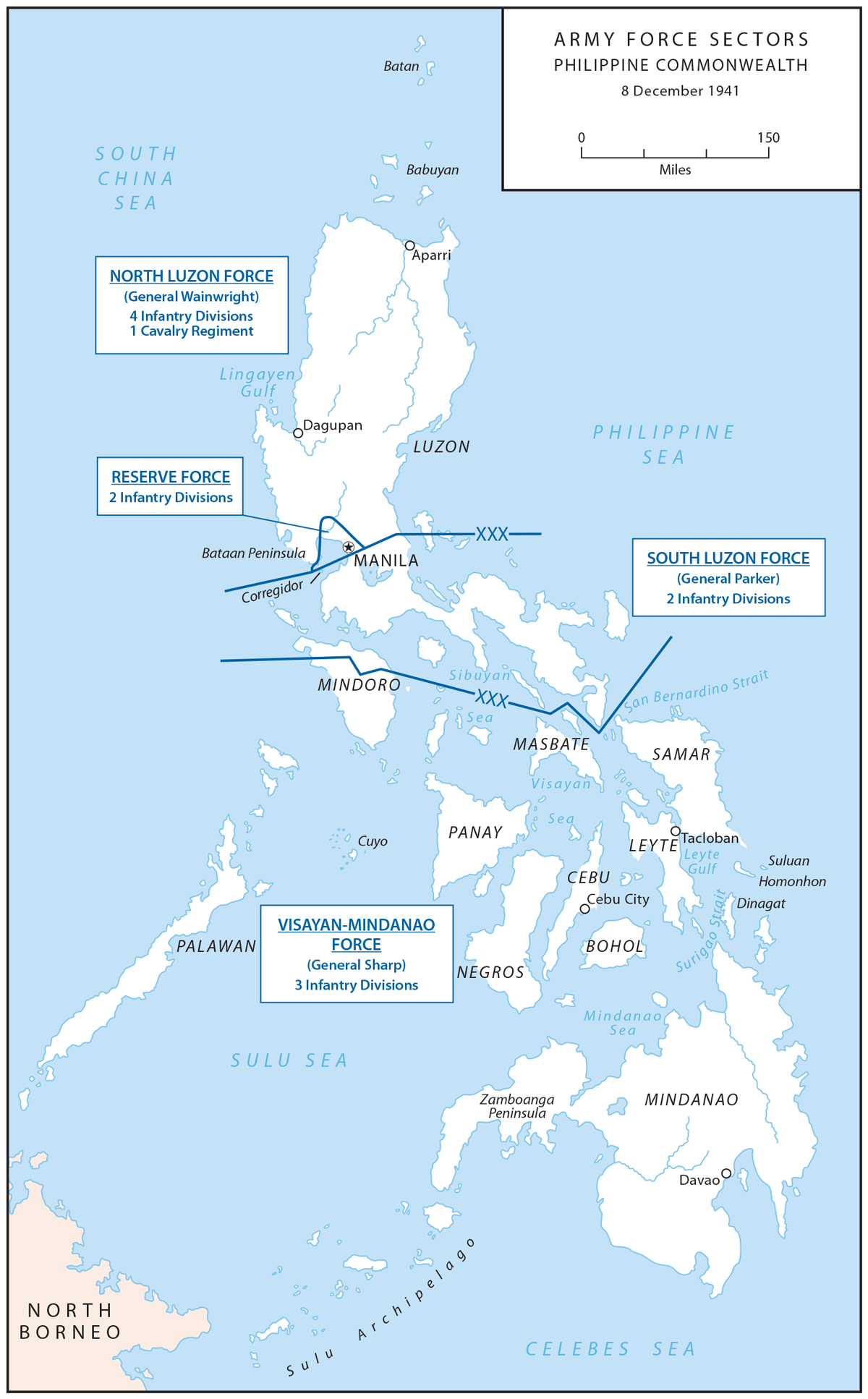
Map 2: Army Force Sectors - Philippine Commonwealth - 8 December 1941
USAFFE (United States Army Forces in the Far East) was created on July 26, 1941, with Douglas MacArthur, who was
recalled to active duty in the U.S. Army as its commander. MacArthur at that point was a major general.
MacArthur's "Defend at the Beaches" plan was an ambitious attempt to prevent a Japanese foothold on Luzon by holding
the invaders at their landing sites.
Due to overwhelming Japanese strength and the defenders' lack of resources, the plan
quickly proved untenable, leading to a strategic withdrawal to Bataan and Corregidor.
USAFFE, despite its size, was
hampered by inadequate training, equipment, and supplies, but its resistance delayed Japanese conquest and tied down
enemy forces for months.
Credits
Map 1: Courtesy of the United States Military Academy Department of History.
Map 2: Courtesy of the Philippine Department, U.S. Army
Related Links
About the Pearl Harbor AttackExact Timeline of the Pearl Harbor Attack
About the Second World War
WWII Timelines
About Franklin D. Roosevelt
About Isoroku Yamamoto
Click map to enlarge.
More History
