When was the Acropolis built?
The Acropolis of Athens has a long and complex history of construction and development, with its origins
dating back to the Neolithic Age (Stone Age approx. 7000 BC to 3000 BC).
Construction on the Acropolis as we know it today began in the 5th century BC, particularly during the
Golden Age of Athens, which began after
the Persian Wars, when Athens emerged
as a dominant power in Greece, leading the Delian League, an alliance of
city-states formed to protect against Persian aggression.
Here the key construction phases:
:: Early Settlements ::
The earliest known settlements on the Acropolis date back to the 3rd millennium BC, with Mycenaean structures
appearing around 1750-1050 BC.
:: Initial Temples ::
The first temple dedicated to Athena, known as the Hecatompedon , was built
around 580 BC. (From the ancient Greek words ἑκατόν (hekatón), meaning "hundred," and ποδός (podós), meaning "foot",
in reference to the size of the building, it literally translates to "hundred-footer".)
:: Destruction and Reconstruction ::
After the Persian Wars, and following the destruction of Athens in 480 BC, Athenian
statesman Pericles initiated a major reconstruction effort around
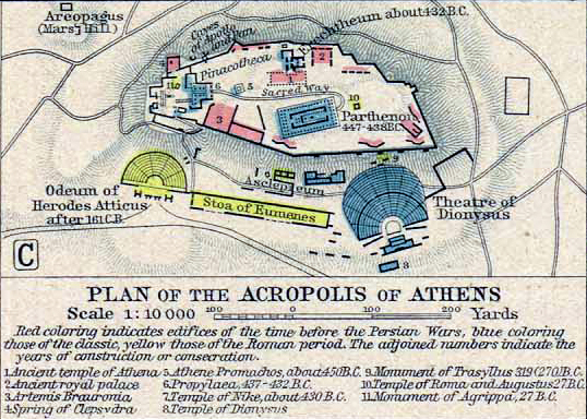
447 BC. This included the construction of several iconic buildings, such as the Parthenon, the Propylaea, the
Temple of Athena Nike, and the Erechtheion.
:: Parthenon Completion ::
The most famous structure, the Parthenon, was completed in 432 BC and served both as a temple to Athena and as
a treasury for the Athenian Empire.
Alongside the Parthenon, other significant constructions during this period included the Propylaea (the gateway)
and the Erechtheion, which were also completed in the mid to late 5th century BC.

