Map Description
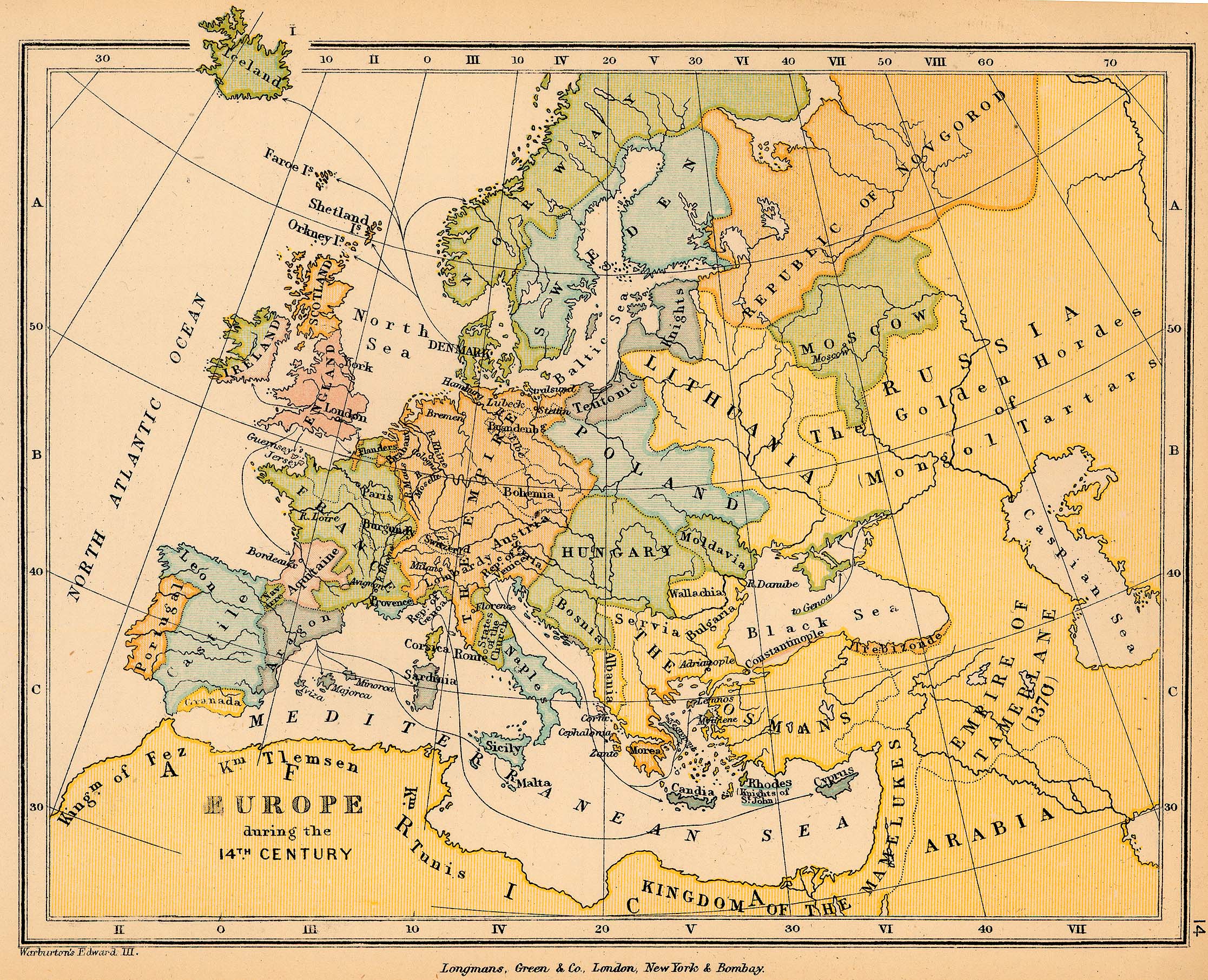
Historical Map of Europe during the 14th Century
Illustrating among others
Portugal, Castile, Leon, Granada, Aragon, Navarre, Aquitaine, France, Provence, The Empire,
Naples, Hungary, Poland, The Osmans, Lithuania, Teutonic Knights, Empire of Tamerlane (1370)
Credits
University of Texas at Austin.
From The Public Schools Historical Atlas edited by C. Colbeck, 1905.
Related Maps
Map of the Medieval Universities in Europe 12th-15th Century
Map of the Grand Catalan Company 1303
Map of the Universities of Europe in the 16th Century
Map of the Universities of Europe until 1618
Map of Europe 13th Century
Map of Europe 15th Century
Map of Medieval Commerce in Europe
Plan of a Medieval Manor

