|
Map Description
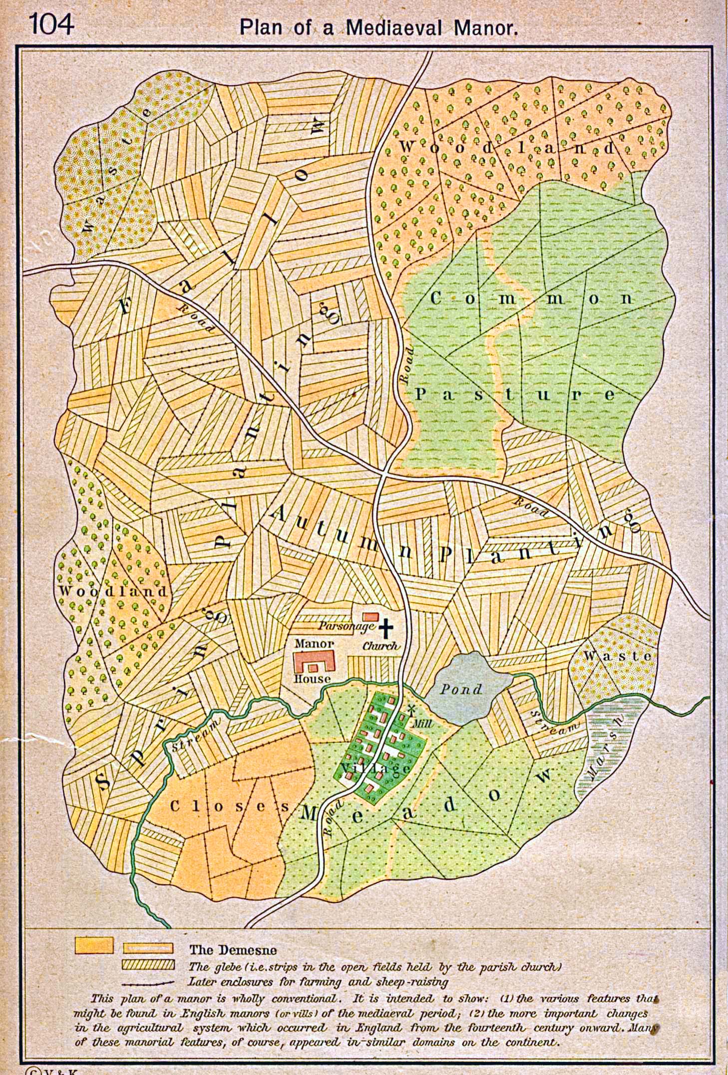
Historical Plan of a Mediaeval
Manor.
Illustrating
- The
Demesne
- The glebe (i.e. strips in the open fields held by the parish
church)
- Later enclosures for farming and sheep-raising
This plan of a manor is wholly conventional. It is intended to
show: (1) the various features
that might be found in English manors (or vills) of the
mediaeval period; (2) the more important
changes in the agricultural system which occurred in England
from the fourteenth century
onward.
Many
of these manorial features, of course, appeared in similar
domains on the continent.
Credits
University of Texas at Austin.
Historical Atlas by William Shepherd (1923-26).
Related Links
 About Charlemagne
Related Maps
 Map of Europe 13th Century
 Map of Medieval Universities
 Map of Medieval Commerce in Europe

More History
 |