|
Map Description
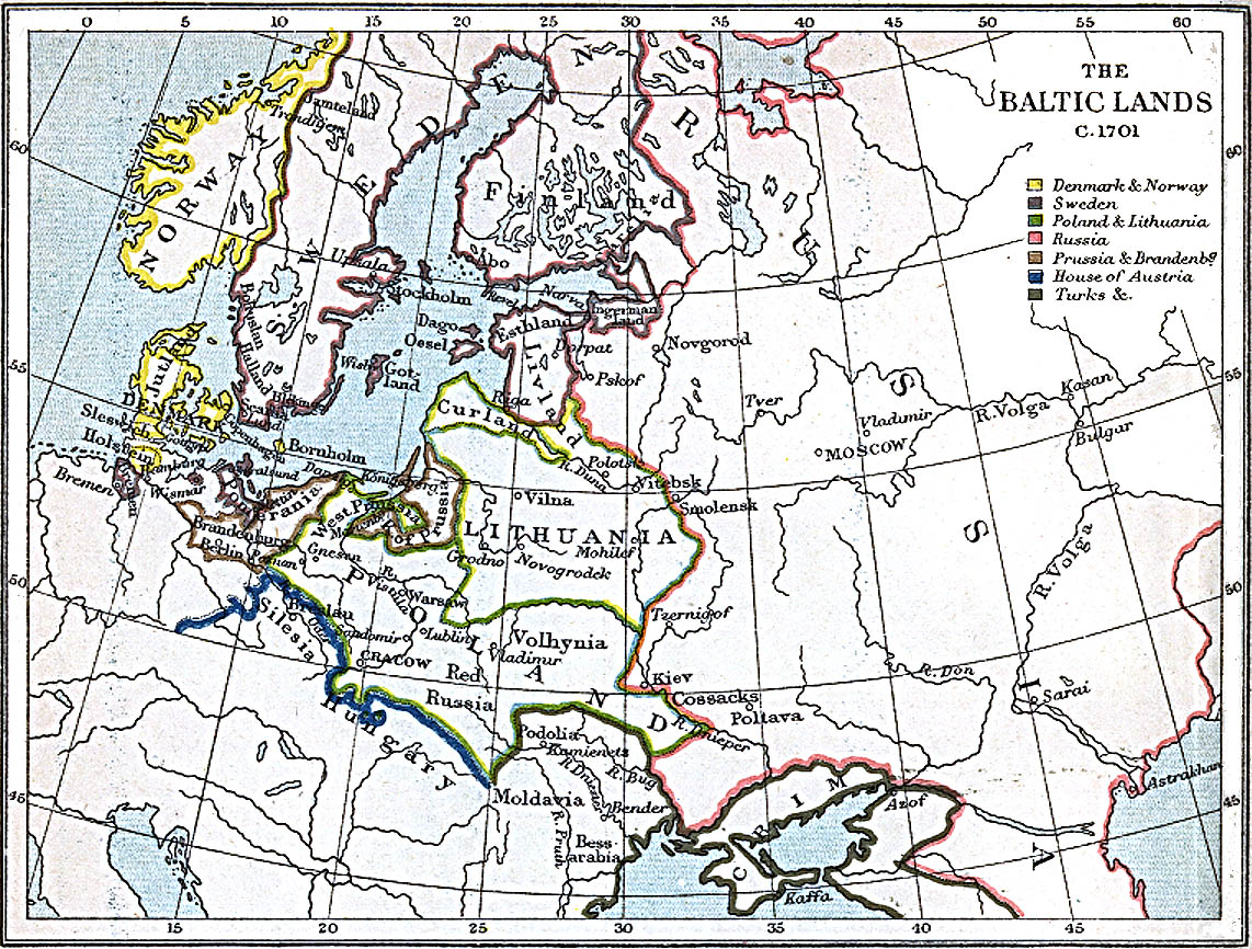
History map of History Map of
the Baltic Lands, c.1701
Illustrating: Denmark & Norway,
Sweden, Poland & Lithuania, Russia, Prussia & Brandenburg,
House of Austria, Turks
Credits
Perry-Castañeda Library Map
Collection. From the Historical Atlas by William R. Shepherd
Related Maps
 Map of the Baltic regions 1386-1560
Map of the Baltic Regions 1560-1661
Map of the Baltic regions 1386-1560
Map of the Baltic Regions 1560-1661
Map of the Baltic Lands in 1661
More History
 |
