|
Map Description
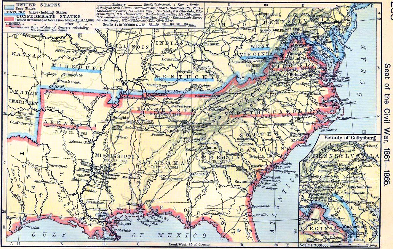
Historical map of the Seat of
the Civil War, 1861-1865.
Inset: Vicinity of Gettysburg.
Illustrating:
United States
- Free States
- Slave-holding States
Confederate States
- Passed Ordinance of Secession before April 15, 1861
- Passed Ordinance of Secession after April 15, 1861
The dates are those of Acts of Congress reinstating the reconstructed
States.
Credits
University of Texas at Austin.
Historical Atlas by William Shepherd (1911).
Related Links
 About the Secession
 About the American Civil War
 About the Confederate States of America

More History
 |