|
Map Description
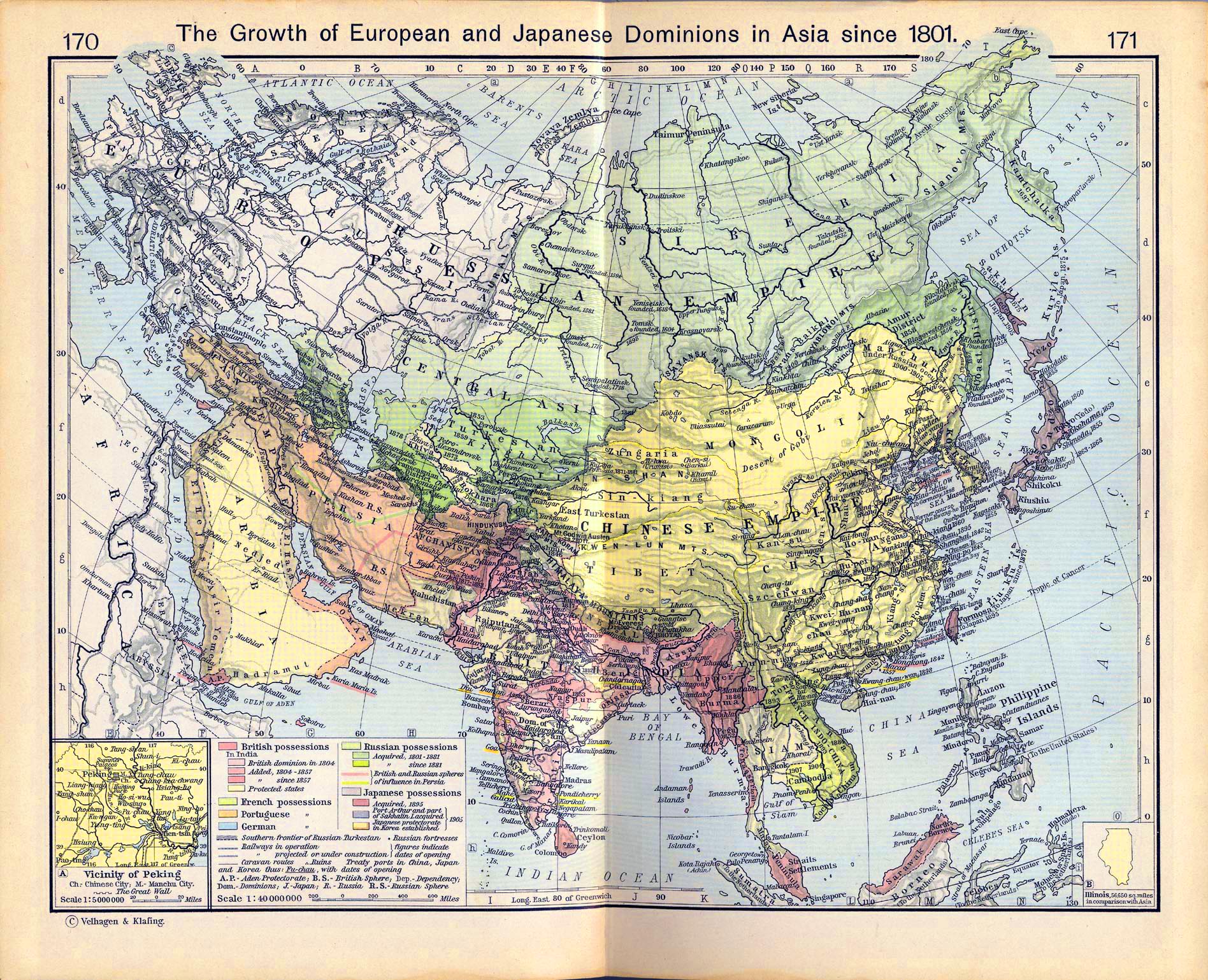
Historical map of the growth of
European and Japanese dominions in Asia since 1801.
Illustrating:
British possessions (In India: British dominion in 1804, added
1804-1857, added, since 1857,
protected states); French possessions; Portuguese possessions;
German possessions; Russian
possessions (acquired 1801-1881; acquired since 1881); British and
Russian spheres of influence
in Persia; Japanese possessions (acquired, 1895; Port Arthur and
part of Sakhalin I. acquired,
1905; Japanese protectorate in Korea established, 1905); Southern
frontier of Russian Turkestan;
Railways in operation; Railways projected or under construction;
Russian fortresses; Caravan
routes; Ruins; Treaty ports in China, Japan, and Korea
Inset: Vicinity of Peking
Chinese City, Manchu City, The Great Wall
Credits
University of Texas at Austin.
Historical Atlas by William Shepherd (1911)
Related Maps
 Map of Russia in Europe - 19th Century
Map of the Russian Expansion in the 19th
Century
Map of Russia in Europe - 19th Century
Map of the Russian Expansion in the 19th
Century
Map of the Chinese Empire 1910
More History
 |
