|
Map Description
Historical Map of Australia and
New Zealand 1788-1911
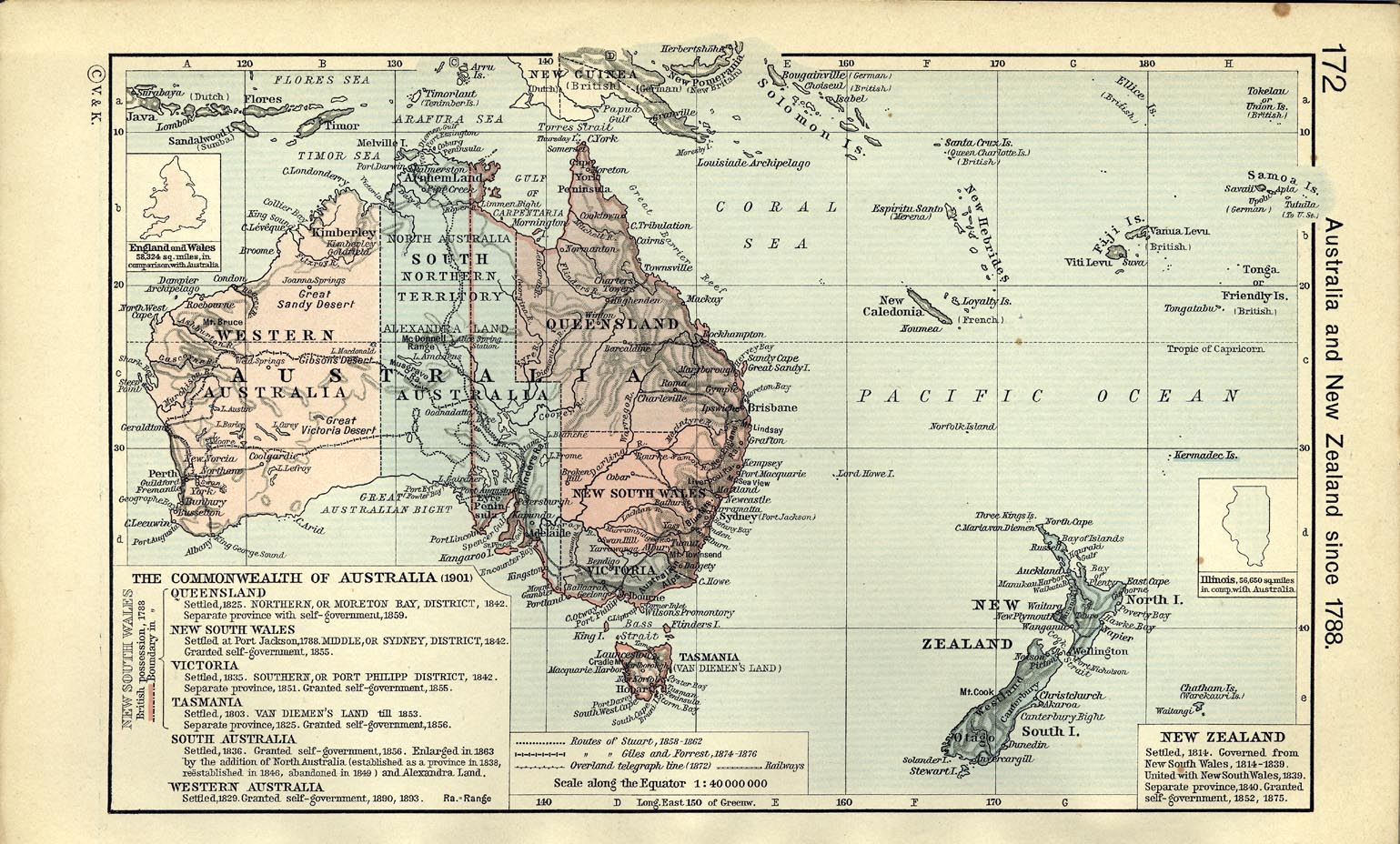
Australia and New Zealand since 1788.
The
Commonwealth of Australia
(1901).
Queensland, Settled, 1825.
Northern, or Moreton Bay, District, 1842, separate province
with self-government, 1859. New South
Wales, settled at Port Jackson, 1788, Middle,
or Sydney, District, 1842, granted self-government, 1855.
Victoria, settled, 1835,
Southern,
or port Philipp District, 1842, separate province, 1851, granted
self-government, 1855.
Tasmania, settled 1803, Van
Diemen's Land till 1853. Separate province, 1825. Granted
self-government 1856. New South Wales,
British possession 1788, boundary in 1788.
South Australia, settled
1836. Granted self-government 1856. Enlarged in 1863 by the
addition of North Australia
(established as a province in 1838, reestablished in 1846,
abandoned in 1849) and Alexandra Land.
Western Australia, settled
1829. Granted self-
government, 1890, 1893.
- Routes
of Stuart, 1858 - 1862
- Routes of Giles and Forrest, 1874 - 1876
- Overland telegraph line (1872)
- Railways
New Zealand, settled, 1814.
Governed from New South Wales, 1814-1839. United with New South
Wales 1839. Separate province, 1840. Granted self-government, 1852,
1875.
Credits
University of Texas at Austin. From
The Historical Atlas by William R. Shepherd, 1911.
Related Maps
 Map of the Australian Colonies 19th Century
 Map of the Dominion of New Zealand
 Map of the Pacific
Ocean 1910

More History
 |