|
Map Description
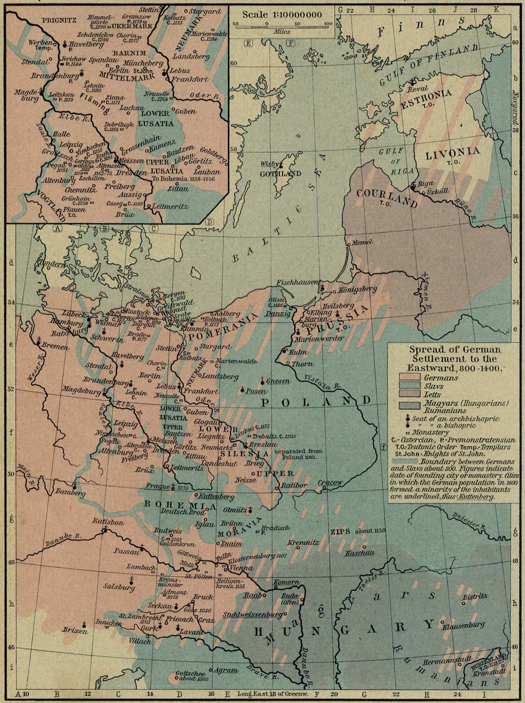
Historical Map of the Spread of
German Settlements to the Eastward, 800-1400.
Illustrating
-
Germans
- Slavs
- Letts
- Magyars (Hungarians), Rumanians
- Seat of an archbishopric
- Seat of a bishopric
- Monastery
- Cistercian
- Premonstratensian
-
 Teutonic Order
- Templars
- Knights of St. John
Boundary between Germans and Slavs about 800. Figures indicate
date of founding city
or monastery. Cities in which the German population in 1400
formed a minority of the
inhabitants are underlined.
Inset: The March of Lusatia
Credits
University of Texas at Austin.
Historical Atlas by William Shepherd (1923-26).
Related Maps
 About the Germanic Migrations

More History
 |