|
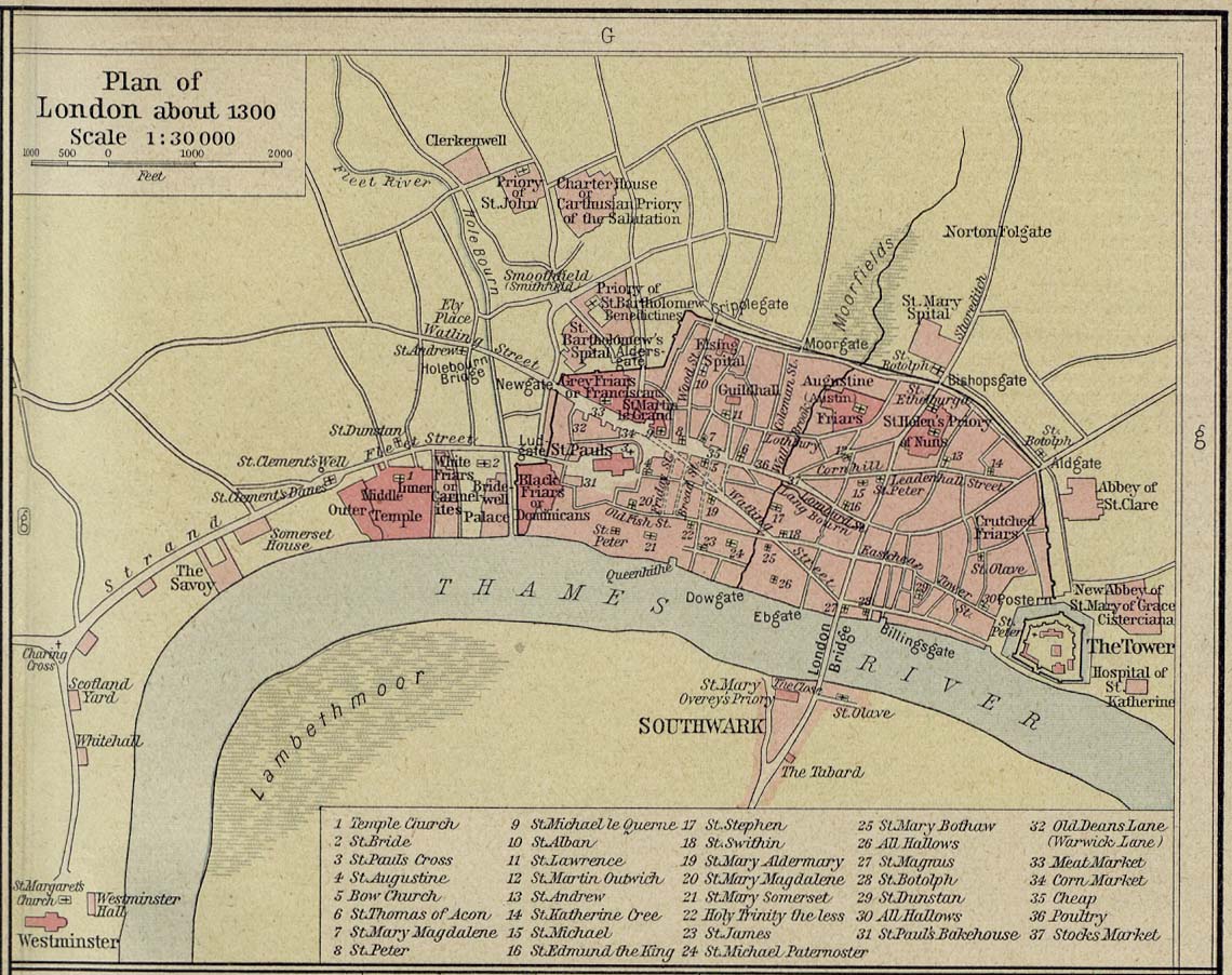
Map Description
Historical Map of London about
1300.
Illustrating
1
Temple Church
2 St. Bride
3 St. Pauls Cross
4 St. Augustine
5 Bow Church
6 St. Thomas of Acon
7 St. Mary Magdalene
8 St. Peter
9 St. Michael le Querne
10 St. Alban
11 St. Lawrence
12 St. Martin Outwich
13 St. Andrew
14 St. Katherine Cree
15 St. Michael
16 St. Edmund the King
17 St. Stephen
18 St. Swithin
19 St. Mary Aldermary
20 St. Mary Magdalene
21 St. Mary Somerset
22 Holy Trinity the less
23 St. James
24 St. Michael Paternoster
25 St. Mary Bothaw
26 All Hallows
27 St. Magnus
28 St. Botolph
29 St. Dunstan
30 All Hallows
31 St. Paul's Bakehouse
32 Old Deans Lane (Warwick Lane)
33 Meat Market
34 Corn Market
35 Cheap
36 Poultry
37 Stocks Market
Credits
University of Texas at Austin.
Historical Atlas by William Shepherd (1923-26).
Related Maps
 Map of the Vicinity of London 1200-1600
 Map of England and France 1455-1494
 Map of England and Wales under the Tudors

More History
 |