Reference Maps on Alexander III the Great, who lived 356-323 BC
Map of Asia Minor under the Greeks and Romans
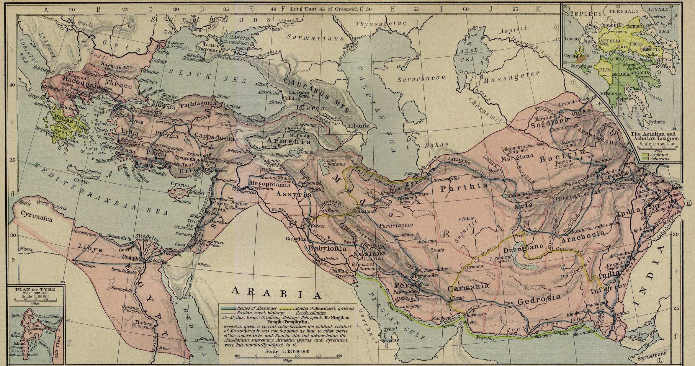
Map of the Macedonian Empire 336-323 BC
Map of the Aetolian and Achaean Leagues at the time of the Macedonian Empire 336-323 BC
Map of the Conquests of Alexander the Great
Map of the Battle of the Granicus 334 BC
Map of the Battle of Issus 333 BC - Movements to the Battlefield
Map of the Battle of Issus 333 BC - Initial Situation
Map of the Battle of Issus 333 BC - Decisive Action
Map of Tyre (Hammond)
Map of Tyre 333-332 BC (Shepherd)
Map of the Siege of Tyre 333-332 BC (USMA)
Map of the Battle of Gaugamela - October 1, 331 BC
Map of the Battle of Gaugamela - October 1, 331 BC - Initial Situation
Map of the Battle of Gaugamela - October 1, 331 BC - Decisive Action
Map of the Battle of the Hydaspes 326 BC - Crossing of the River
Map of the Battle of the Hydaspes 326 BC - Combined Arms Attack
Two Maps of the Kingdoms of the Diadochi (Successors) of the Macedonian Empire in 301 BC and in 200 BC
Map of the Macedonian Empire after the Battle of Ipsus 301 BC