|
Map Description
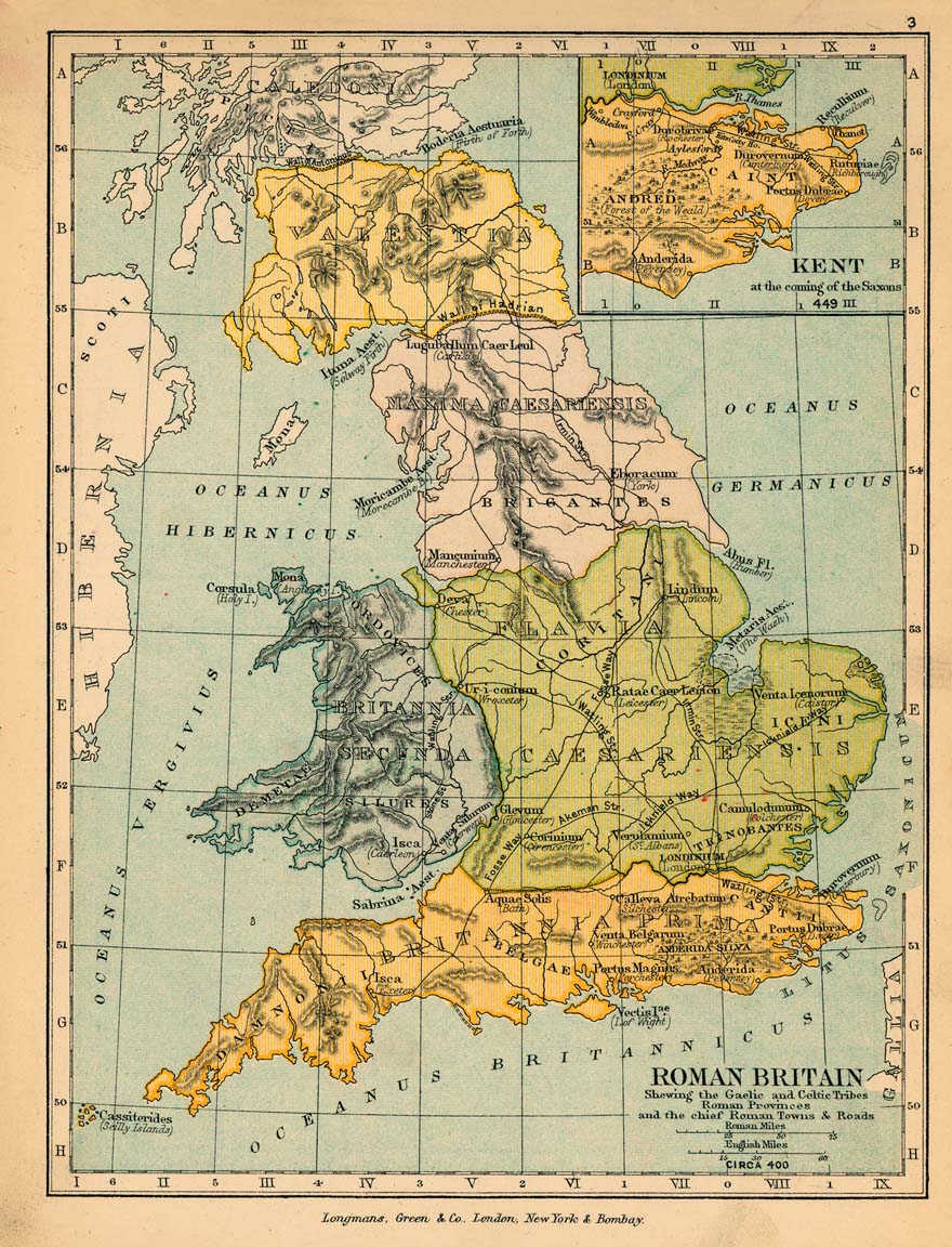
Historical Map of Roman Britain
Circa 400.
Illustrating
Showing the Gaelic and Celtic Tribes Roman Provinces and the
chief Roman Towns and Roads
Inset: Kent at the coming of the
Saxons in 449
Credits
University of Texas at Austin.
From the Public Schools Historical Atlas by C. Colbeck, 1905.
Related Links
 About the Saxons
 About Hadrian
 About Julius Caesar
 Roman Britain
Related Maps
 Map of the Limes in Britain AD 122
 Map of Kent in 449
 Map of Roman Britain around 410
 Map of
Gaul in the Time of Caesar
 Map of the European Provinces of the Roman
Empire
 Map of Hadrian's Wall
 Map of the Antonine Wall

More History
 |