|
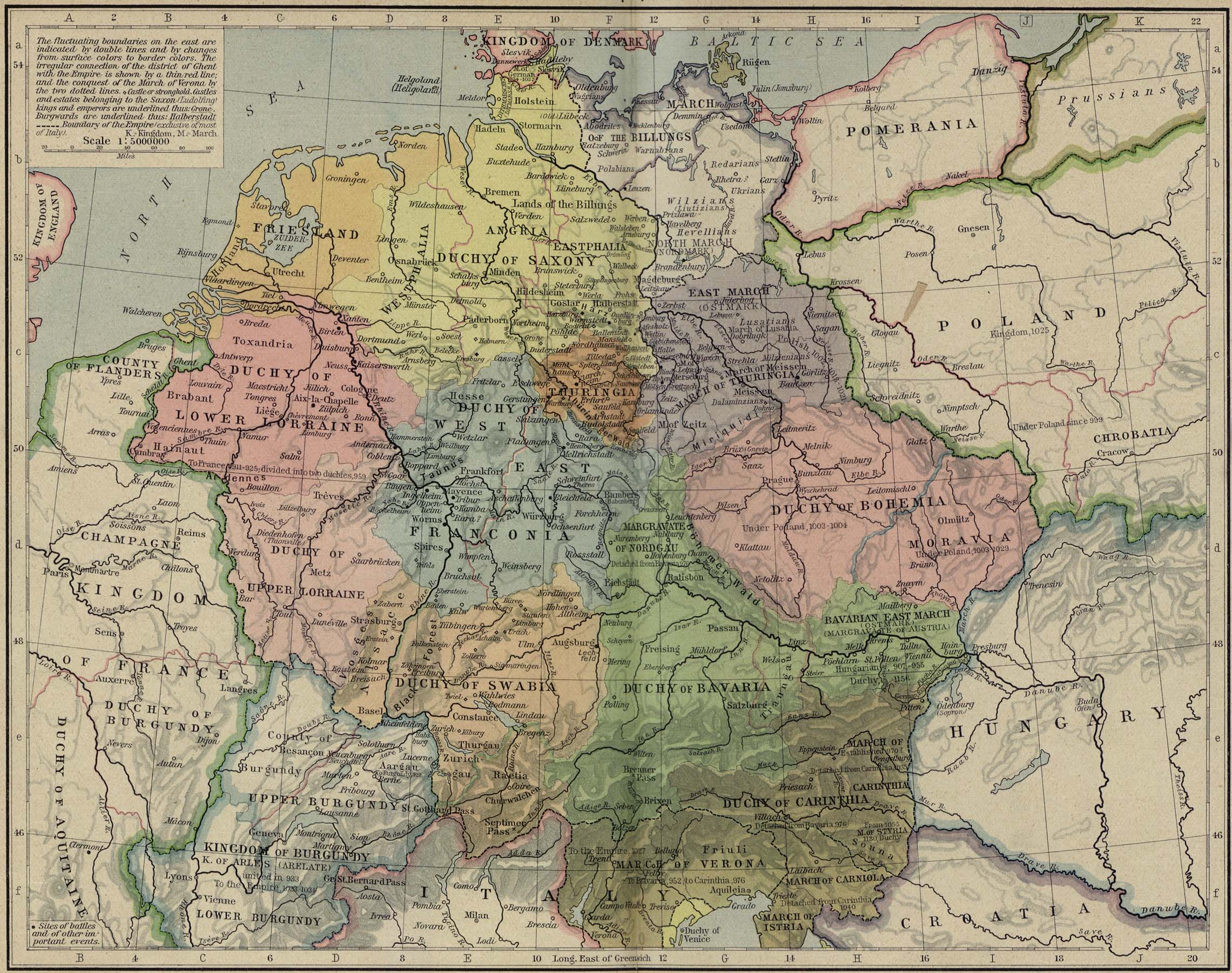
Map Description
Historical Map of Central
Europe 919-1125
Illustrating
-
Sites of battles and other important events
The fluctuating boundaries on the east are indicated by double
lines and by changes from surface
colors to border colors. The irregular connection of the
district of Ghent with the Empire is shown by
a thin red line; and the conquest of the
March of Verona by the
two dotted lines.
- Castle or stronghold
Castles and estates belonging to the Saxon (Ludolfing) kings and
emperors are underlined.
 About the
Ludolfing Kings
Burgwards are underlined with a dotted line.
- Boundary of the Empire (exclusive of most of Italy)
 About the Holy Roman Empire
Credits
University of Texas at Austin.
From the Historical Atlas by William Shepherd (1923-26).
Related Maps
 Map of Europe in 912
 Map of Central Europe
in 980

More History
 |