|
Map Description
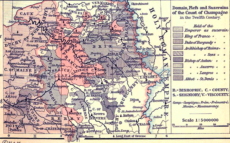
Historical Map of the Domain,
Fiefs and Suzerains of the Count of Champagne in the Twelfth
Century.
Illustrating
Held
of the
- Emperor as suzerain
- King of France as suzerain
- Duke of Burgundy as suzerain
- Archbishop of Reims as suzerain
- Archbishop of Sens as suzerain
- Bishop of Autun as suzerain
- Bishop if Auxerre as suzerain
- Bishop of Langres as suzerain
- Abbot of St. Denis as suzerain
B - Bishopric
C - County
S - Seigniory
V - Viscounty
Comp - Compiègne
Prem - Prémontré
Montm - Montmorency
Credits
University of Texas at Austin.
Historical Atlas by William Shepherd (1911).
Related Maps
 Map of France around 1035
 Map of France 1154-1184

More History
 |