|
Map Description
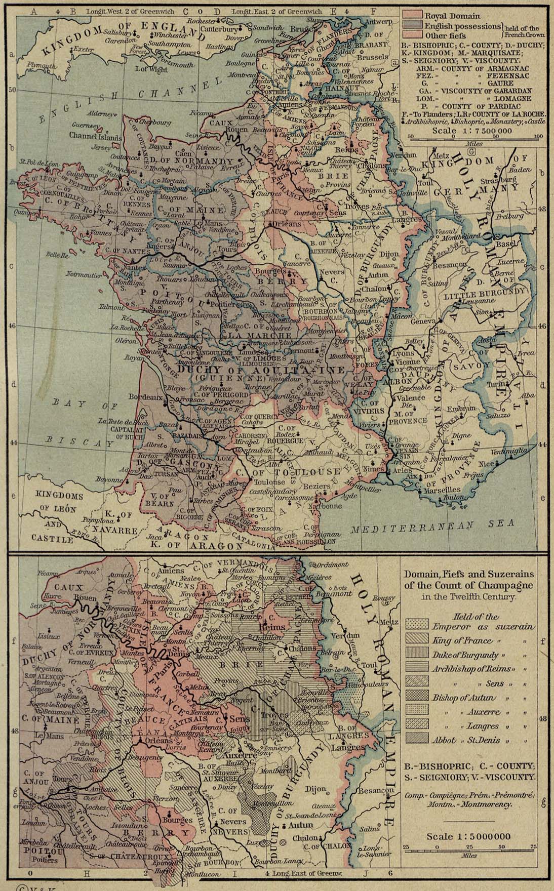
History Map of France
1154-1184.
Illustrating
-
Royal domain
- English possessions held of the French Crown
- Other fiefs held of the French Crown
Inset: Domain, Fiefs and Suzerains of the Count of Champagne in the
Twelfth Century.
Held
of the
- Emperor as suzerain
- King of France as suzerain
- Duke of Burgundy as suzerain
- Archbishop of Reims as suzerain
- Archbishop of Sens as suzerain
- Bishop of Autun as suzerain
- Bishop of Auzerre as suzerain
- Bishop of Langres as suzerain
- Abbot of St. Denis as suzerain
Credits
University of Texas. Historical
Atlas by William Shepherd (1923-26).
Related Links
 About Blois
Related Maps
 Map of Champagne 12th Century
 Map of France in 1328
 Map of France in 1453

More History
 |