|
Map Description
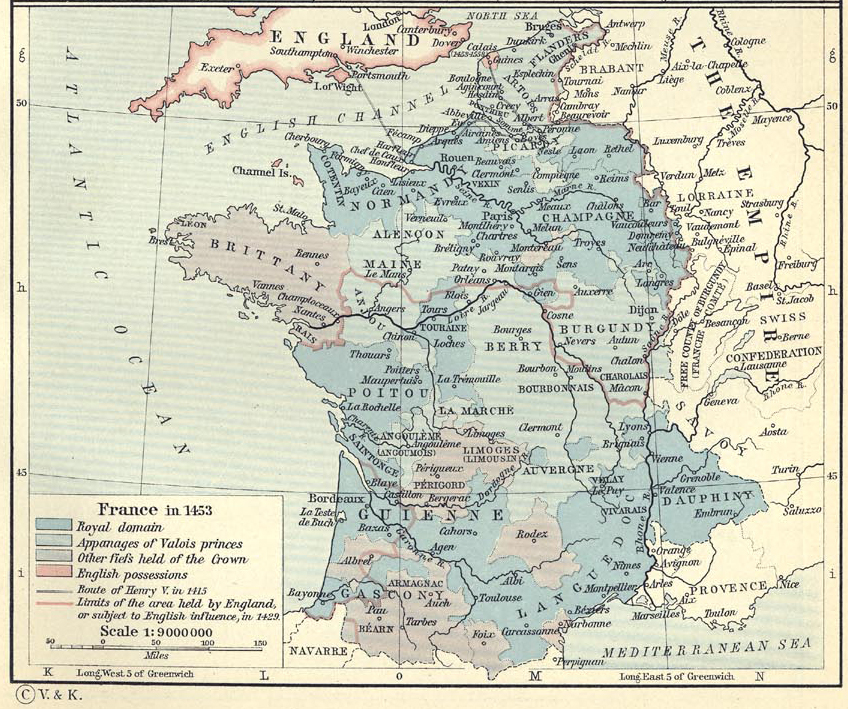
Historical Map of France in 1453.
Illustrating
- Royal domain
- Appanages of Valois princes
- Other fiefs held of the Crown
- English possessions
- Route of
 Henry V
in 1415
- Limits of the area held by England or subject to English
influence, in 1429
Credits
University of Texas at Austin.
From The Historical Atlas by William R. Shepherd, 1911.
Related Maps
 Map of France 1154-1184
 Map of France in 1328

More History
 |