|
Map Description
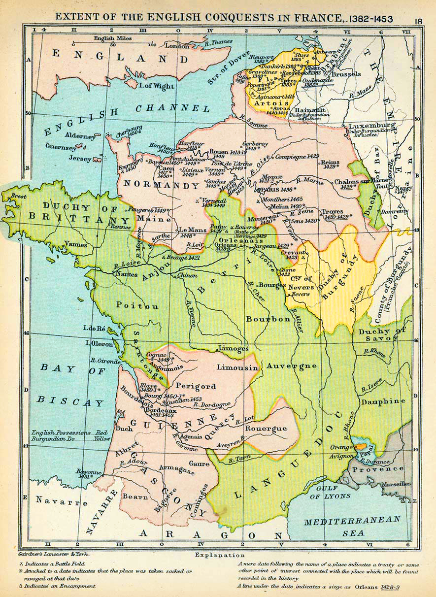
Historical Map of the Extent of
the English Conquests in France, 1382-1453.
Illustrating
- Battlefields
- Places taken sacked or ravaged
- Encampments
A mere date following the name of a place indicates a treaty or
some other point of interest
connected with the place which will be found recorded in the
history.
A line under the date indicates a siege.
Credits
University of Texas at Austin.
From The Public Schools Historical Atlas edited by C. Colbeck, 1905.
Related Links
 About the Hundred Years' War
 About Joan of Arc

More History
 |