|
Map Description
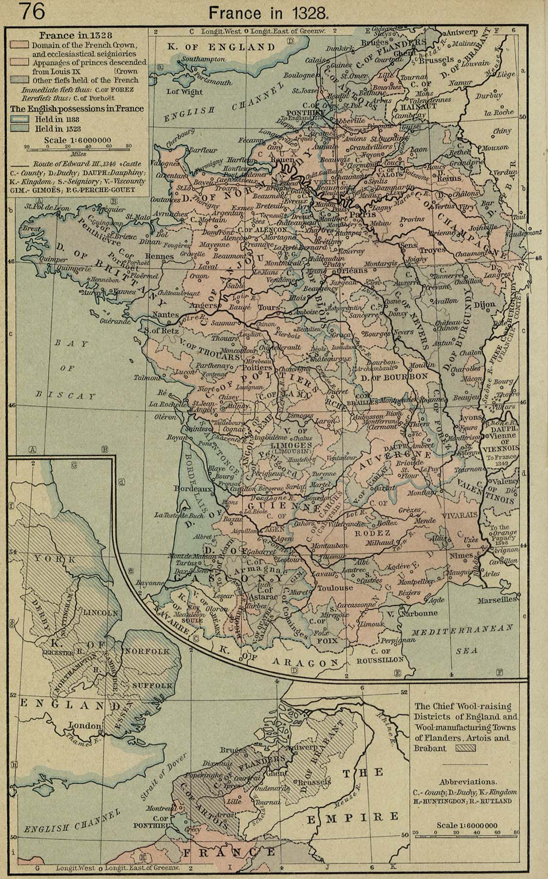
Historical Map of France in
1328.
Illustrating
Domain of the French Crown, and ecclesiastical seigniories
Appanages of princes descended from Louis IX
Other fiefs held of the French Crown
Immediate fiefs
Rerefiefs
The English possessions in France
- Held in 1188
- Held in 1328
The Chief Wool-raising Districts of England and
Wool-manufacturing Towns of Flanders, Artois and Brabant
Credits
University of Texas at Austin.
Historical Atlas by William Shepherd (1923-26).
Related Links
 About Louis IX
 About Edward III
Related Maps
 Map of France 1154-1184
 Map of France 1327-1377
 Map of France in 1453

More History
 |