|
Map Description
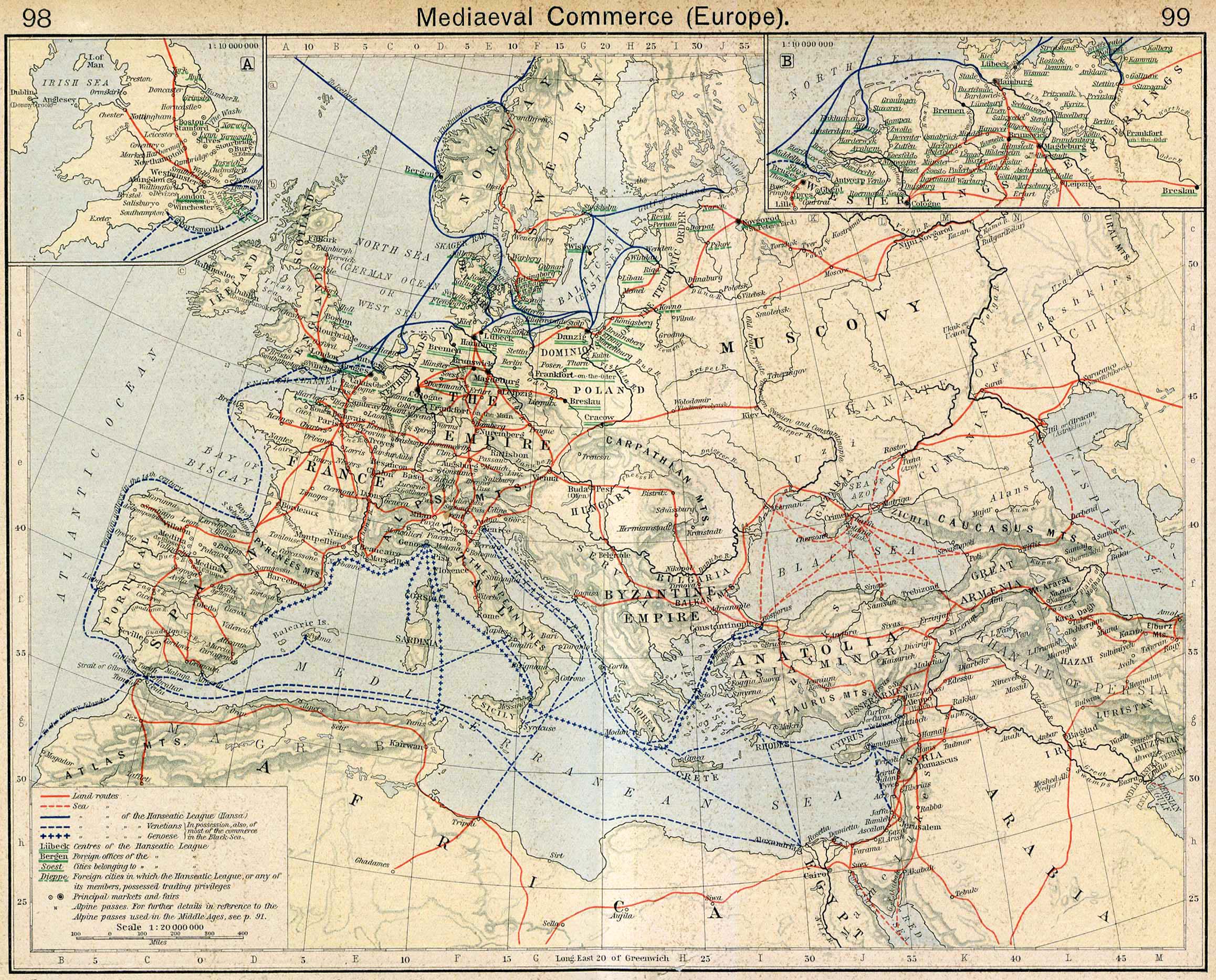
Historical Map of Mediaeval
Commerce in Europe.
Illustrating
-
Land routes
- Sea routes
- Sea routes of the Hanseatic League (Hansa)
- Sea routes of the Venetians (In possession also of most of the
commerce in the Black Sea.)
- Sea routes of the Genoese (In possession also of most of the
commerce in the Black Sea.)
- Centers of the Hanseatic League
- Foreign offices of the Hanseatic League
- Cities belonging to the Hanseatic League
- Foreign cities in which the Hanseatic League, or any of its
members, possessed trading privileges
- Principal markets and fairs
- Alpine passes. For further details in reference to the Alpine
passes used in the Middle Ages, see
 Map of the Swiss Confederation 1291-1513.
Inset A: Mediaeval Commerce in England
Inset B: Hanseatic League in Northern
Germany
Credits
University of Texas at Austin.
Historical Atlas by William Shepherd (1923-26)
Related Links
 About the Hanseatic League
Related Maps
 Map of Commerce in Medieval Asia
 Map of Marco Polo
Travels Between 1271 and 1295
 Plan of a Mediaeval Manor
 Map of the Swiss Confederation 1291

More History
 |