|
Map Description
Historical Plan of the Roman
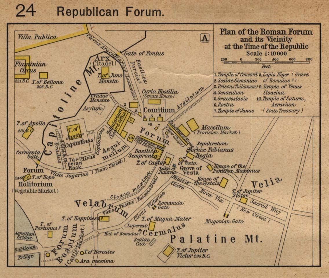
Forum and its Vicinity at the Time of the Republic (A) and
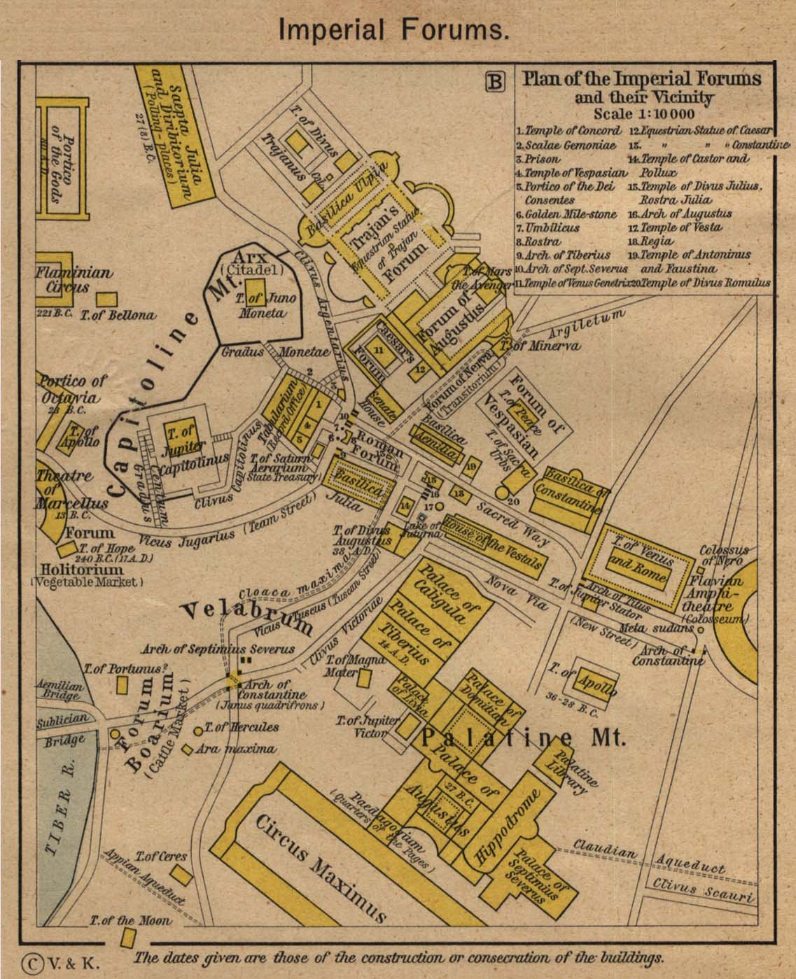
Plan of the Imperial Forums and their Vicinity (B).
Republican Forum
Plan of the Roman Forum and its vicinity at the time of the Republic
1 Temple of Concord
2 Scalae Gemoniae
3 Prison (Tullianum)
4 Senaculum
5 Graecostasis
6 Rostra
7 Temple of Janus
8 Lapis Niger (Grave of Romulus?)
9 Temple of Venus Cloacina
10 Temple of Saturn, Aerarium (State Treasury)
Imperial Forums
Plan of the Imperial Forums and their vicinity.
1 Temple of Concord
2 Scalae Gemoniae
3 Prison
4 Temple of
 Vespasian
5 Portico of the Dei Consentes
6 Golden Milestone
7 Umbilicus
8 Rostra
9 Arch of Tiberius
10 Arch of Sept. Severus
11 Temple of Venus Genetrix
12 Equestrian Statue of Caesar
13 Equestrian Statue of Constantine
14 Temple of Castor and Pollux
15 Temple of Divus Julius, Rostra Julia
16 Arch of Augustus
17 Temple of Vesta
18 Regia
19 Temple of Antoninus and Faustina
20 Temple of Divus Romulus
Credits
University of Texas at Austin.
Historical Atlas by William Shepherd (1923-26).
Related Links
 About Julius Caesar
 About the Roman Republic
 About the Roman Empire
 About Ancient Rome
Related Maps
 Map of Rome's Expansion 264 BC - 180 AD
 Map of the Vicinity of Rome 2nd Century AD
 Map of Rome 350 AD
 Map of Rome in the Middle Ages
 Map of Roman Bishoprics 12th Century


More History
 |