|
Map Description
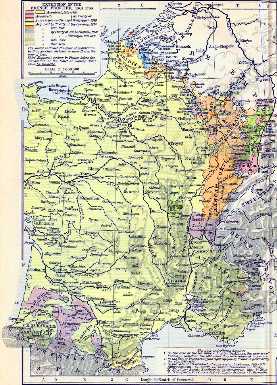
Historical Map of the Extension
of the French Frontier 1601-1766.
Illustrating:
-
Territories acquired, 1601-1643
- Territories acquired by
 Treaty of Westphalia, 1648
- Possession confirmed by
 Treaty of Westphalia, 1648
- Territories acquired by
 Treaty of the Pyrenees, 1659
- Territories acquired 1661-1662
- Territories acquired by
 Treaty of Aix-la-Chapelle, 1668
- Territories acquired by
 Treaty of Nimwegen, 1678-1679
- Territories acquired 1680-1697
- Territories acquired 1697-1766
- Chief
 Huguenot centers in France before the Revocation of the
 Edict of Nantes (1685)
The dates indicate the year of acquisition by France; when enclosed
in parentheses, the year of loss.
The pink underlining denotes:
1) in
the case of the ten imperial cities in Alsace, the exercise of
French jurisdiction till 1672,
when they were annexed to France.
2) in the case of Philippsburg, the right enjoyed by France of
garrisoning the city, 1648-1679
3) in the case of Alt Breisach, the possession by France,
1648-1679
Credits
University of Texas at Austin.
Historical Atlas by William Shepherd (1911).
Related Links
 About the Thirty Years' War
 About the Franco-Spanish War of 1635
 About the War of
Devolution
 About the Dutch War
Related Maps
 Map of the Treaty Adjustments 1668-1699
 Map of the Treaty Adjustments 1713-1763

More History
 |