|
Map Description
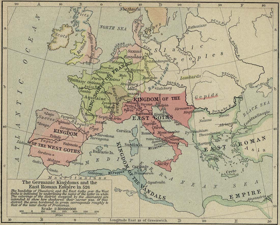
Historical Map of the Germanic
Kingdoms and the East Roman Empire in 526
The headship of
 Theodoric
and the East Goths over the West Goths is indicated by underlining
the name of the latter in white. The colorings of the district
occupied by the
 Alamanni
are intended to show how checkered their career was. Of this
district the area bordered in
green corresponds roughly to that of the later duchy of Franconia.
Credits
University of Texas at Austin.
Historical Atlas by William Shepherd (1923-26)
Related Links
 About Saint Benedict
 About the East Roman Empire
 About the Goths
Related Maps
 Map of Attila's Empire
 Map of the Germanic Migrations
 Map of the Germanic Kingdoms and the East
Roman Empire 486
 Map of Europe and the
East Roman Empire 533-600
 Map of the Settlements of Angles, Saxons and
Jutes in Britain, 600

More History
 |