|
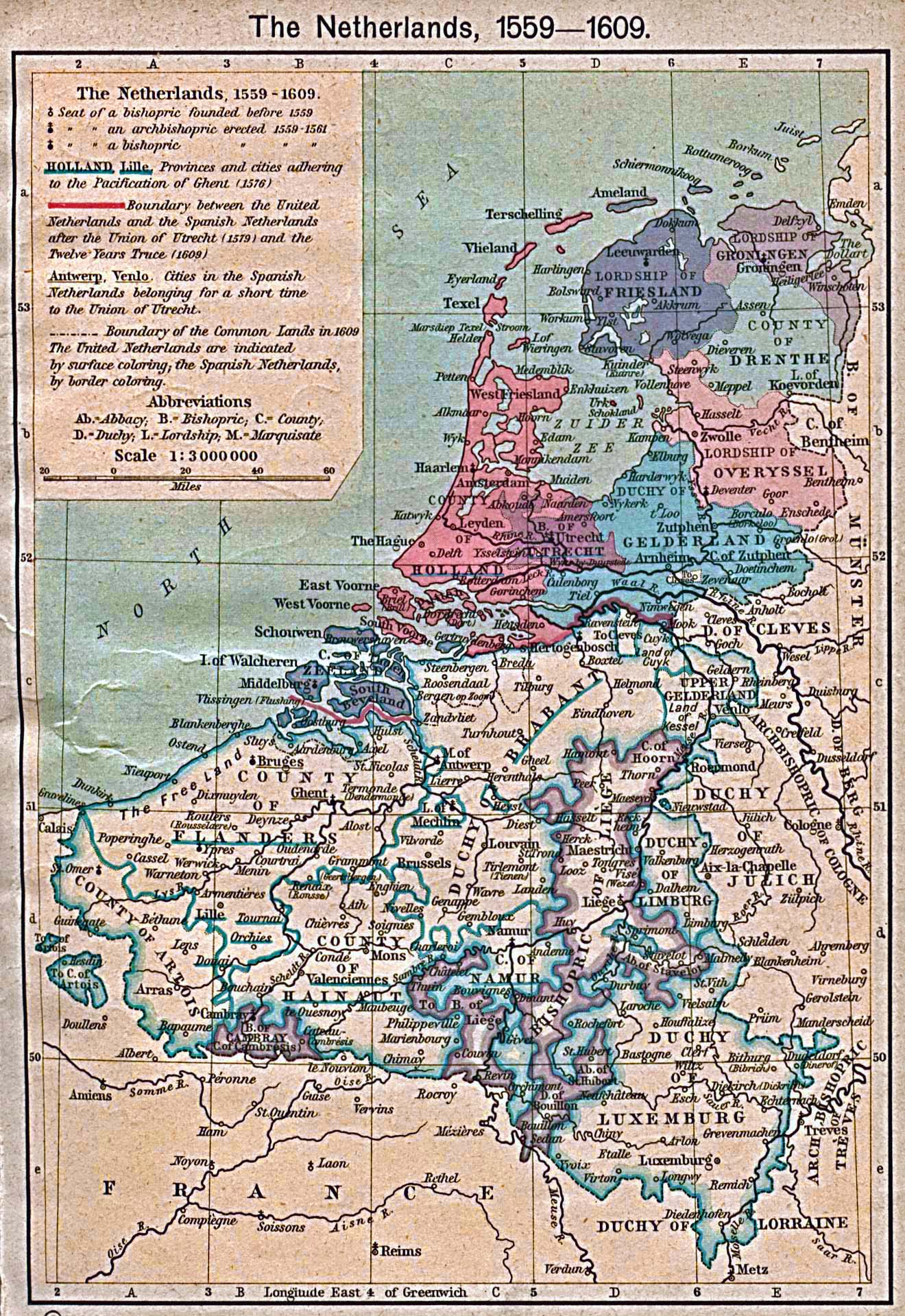
Map Description
Historical Map of the
Netherlands 1559-1609.
The Pacification of Ghent, 1576. Union of Utrecht, 1579. Twelve
Years Truce, 1609.
Illustrating
Seat
of a bishopric founded before 1559
Seat of an archbishopric erected 1559-1561
Seat of a bishopric erected 1559-1561
Provinces and cities adhering to the Pacification of Ghent
(1576)
Boundary between the United Netherlands and the Spanish
Netherlands after the Union
of Utrecht (1579) and the Twelve
Years Truce (1609)
Cities in the Spanish Netherlands belonging for a short time to
the Union of Utrecht.
Boundary of the Common Lands in 1609
The United Netherlands are indicated by surface coloring, the
Spanish Netherlands, by
border coloring.
Credits
University of Texas at Austin.
Historical Atlas by William Shepherd (1923-26).
Related Maps
 Map of the Netherlands: The Wars of
Independence
 Map of the Netherlands 1558-1603
 Map of the Netherlands and Western Germany:
The Wars of 1648-1715

More History
 |