|
Map Description
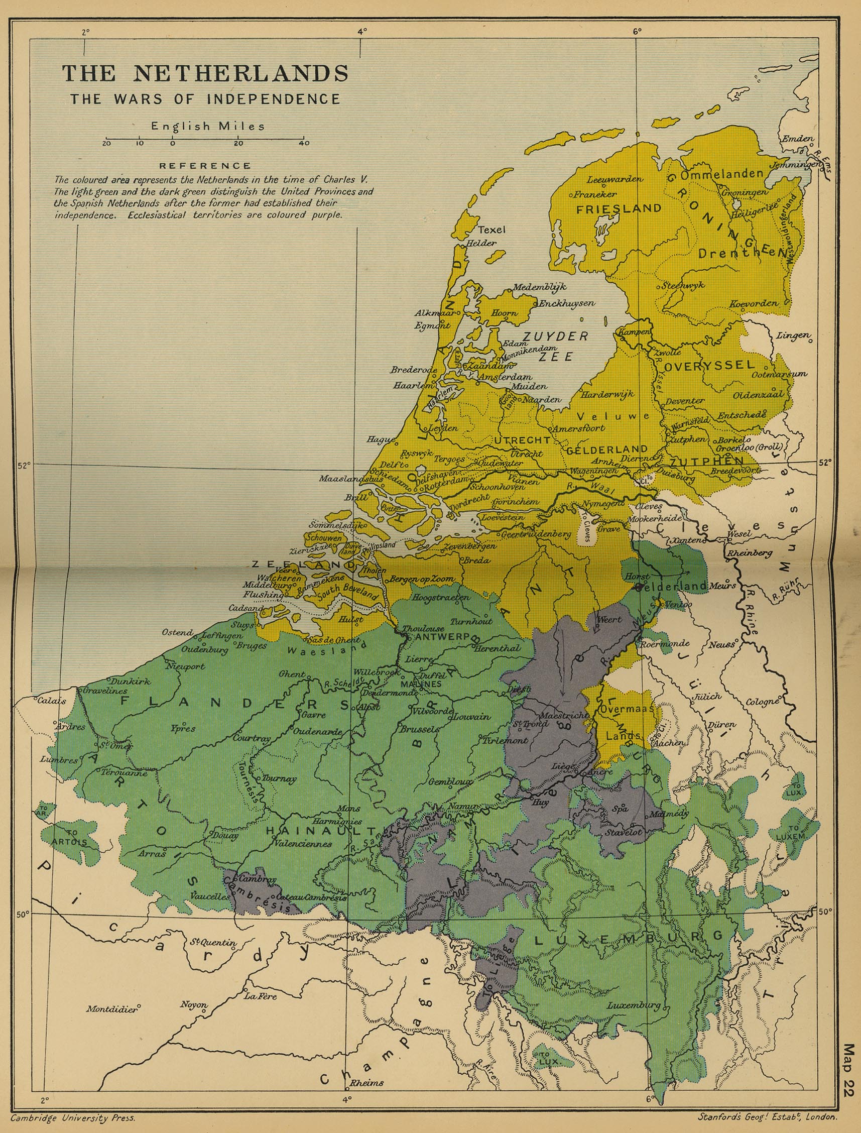
Historical Map of the
Netherlands - The Wars of Independence.
Illustrating
The
colored area represents the Netherlands in the time of
 Charles V.
The
light green and the dark green distinguish the United Provinces
and the Spanish
Netherlands after the former had established their independence.
Ecclesiastical territories are colored purple.
Credits
University of Texas at Austin.
Cambridge Modern History Atlas, 1912.
Related Links
 About the Eighty Years' War
Related Maps
 Map of the Netherlands 1559-1609
 Map of the Netherlands and Western Germany:
The Wars of 1648-1715

More History
 |