|
Map Description
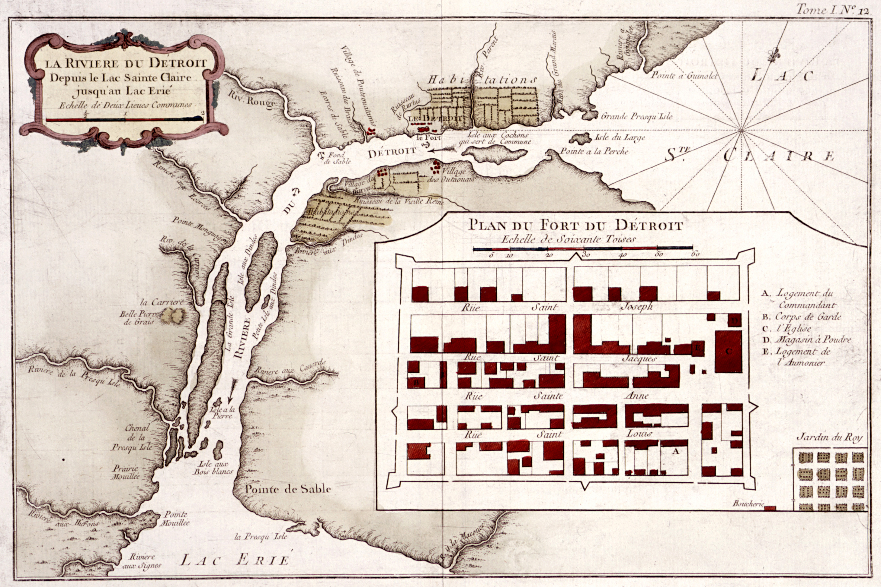
Historical Map of Fort
Pontchartrain du Détroit / Fort Detroit
Detroit
River From Lake St. Clair to Lake Erie
Scale of two common leagues (ancient French unit of length
measurement)
La Riviere du Detroit Depuis le Lac Sainte Claire jusqu'au Lac Erie
Echelle de Deux Lieues Communes
Illustrating
Plan
du fort du Detroit / Map of Fort Detroit
Village de Hurons
Village de Pouteouatamis
Village des Outaouats
Credits
From Histoire générale des Voyages
(Paris, 1746-1759; 15 volumes) by l'Abbé Antoine François Prévost
with maps and views by Jacques-Nicolas Bellin; made available online
by Columbia University
Related Links
 Pontiac's War Council at the Ecorse River
 Pontiac's Rebellion
 A Picture of Fort Detroit in 1701
 Battle of Bloody Run
Related Maps
 Map of Pontiac's War (all forts and battles)
 Map of the Battle of Bushy Run

More History
 |