|
Map Description
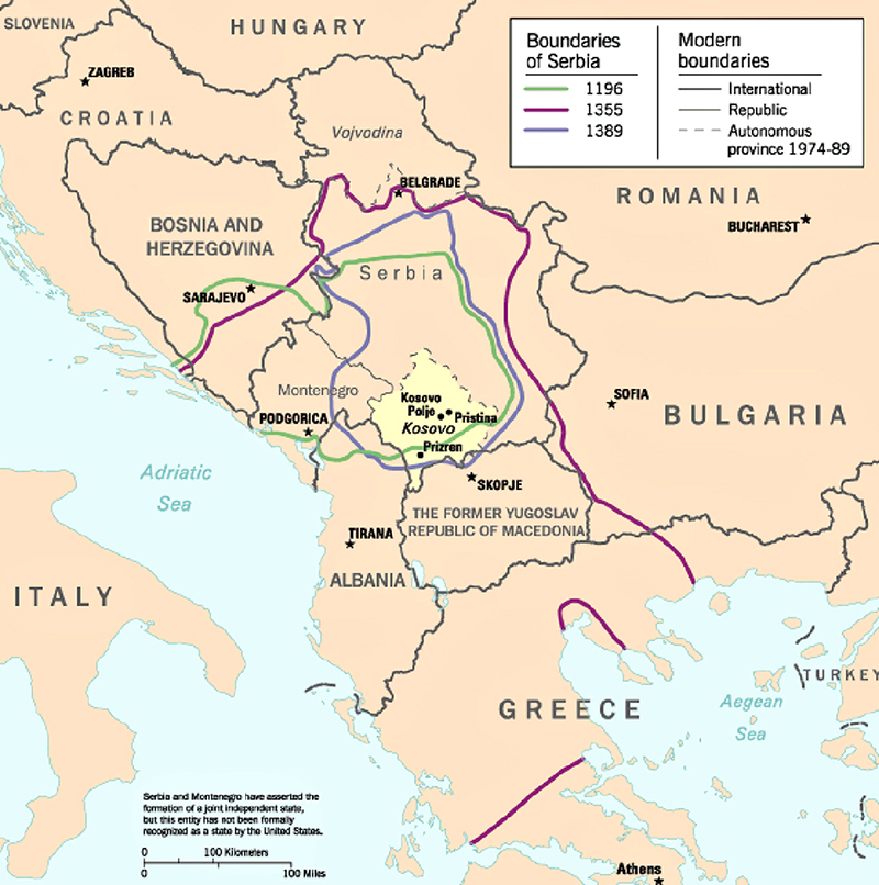
History Map of Serbia 1196-1998
Illustrating
Boundaries of Serbia 1196
Boundaries of Serbia 1355
Boundaries of Serbia 1389
Modern boundaries
- International
- Republic
- Autonomous Province 1974-1989
Serbia and Montenegro have asserted the formation of a joint
independent state, but this entity has not been formally
recognized as a state by the United States.
Slovenia
Croatia
Zagreb
Hungary
Bosnia and Herzegovina
Sarajevo
Montenegro
Podgorica
Vojvodina
Belgrade
Serbia
Kosovo
Kosovo Polje
Pristina
Skopje
Romania
Bucharest
Bulgaria
Sofia
Italy
Albania
Tirana
The Former Yugoslav Republic of Macedonia
Greece
Athens
Turkey
Aegean Sea
Adriatic Sea
Credits
From Kosovo: History of a
Balkan Hot Spot, U.S. Central Intelligence Agency, Office of DCI
Interagency Balkan Task Force, June 1998.
Perry-Castaņeda Library Map Collection, The University of Texas at
Austin.
Related Maps
 Map of the Balkan Peninsula 1878-1910
 Map of the distribution of races in the Balkan
Peninsula and Asia Minor 1911
 Map of WWII: The Balkans 1941
 Map of WWI: Invasions of Serbia - 1914
 Map of WWI: Serbia and the Salonika Expedition
- 1915

More History
 |