|
Map Description
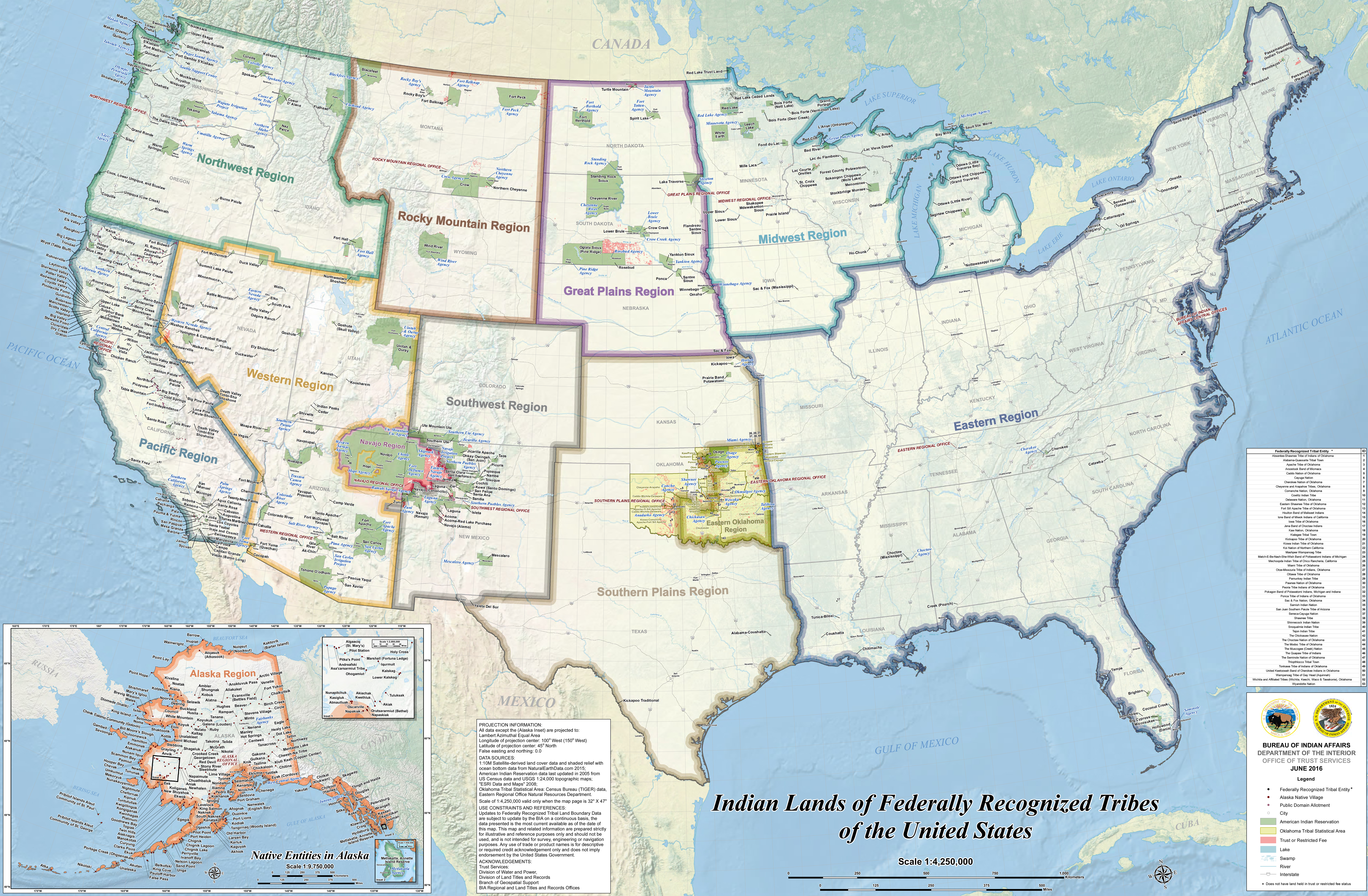
Map illustrating Indian Lands
of Federally Recognized Tribes of the United States
Black
Dot - Federally Recognized Tribal Entity
(Does not have land held in trust or restricted fee status)
Red Dot - Alaska Native Village
Purple Dot - Public Domain Allotment
White Dot - City
Green Shade - American Indian Reservation
Yellow Shade - Oklahoma Tribal Statistical Area
Pink Shade - Trust or Restricted Fee
Blue Shade - Lake
Swamp
River
Interstate
Inset:
Native Entities in Alaska ( Go here for a map that shows this Alaska
inset only)
Credits
Bureau of Indian Affairs / Department of the Interiror / Office
of Trust Services,
June 2016
Related Links
 Alaska Purchase
 Native
Americans - Map List
 About the Cheyenne
 Pontiac's Rebellion

More History
 |