|
Map Description
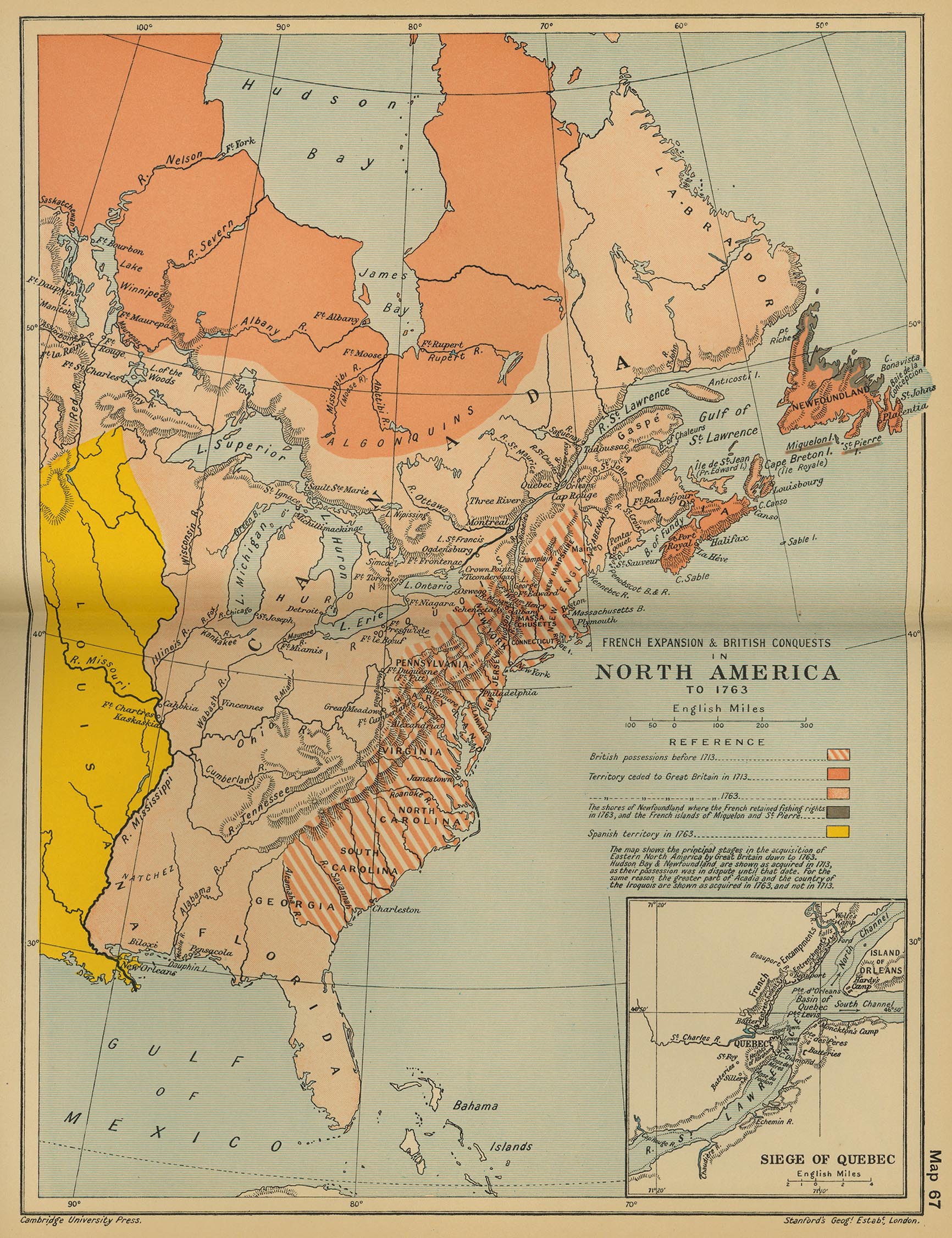
Historical Map of the French
Expansion and British Conquests in North America to 1763.
Inset: Siege of Quebec ( About the Siege of Quebec)
Illustrating:
-
British possessions before 1713
- Territory ceded to Great Britain in 1713 ( About the Treaties of Utrecht)
- Territory ceded to Great Britain in 1763 ( About the Treaty of Paris)
- The shores of Newfoundland where the French retained fishing
rights in 1763, and the
French islands of Miquelon and St. Pierre
- Spanish territory in 1763 ( About the Treaty of Paris)
The map
shows the principal stages in the acquisition of Eastern North
America by Great Britain
down to 1763. Hudson Bay and Newfoundland are shown as acquired in
1713, as their possession
was in dispute until that date. For the same reason the greater part
of Acadia and the country
of the Iroquois are shown as acquired in 1763, and not in 1713.
Credits
University of Texas at Austin.
From the Cambridge Modern History Atlas, 1912.
Related Links
 About the Hudson's Bay Company
Related Maps
 Map of the European Colonization in North
America to 1700
 Map of North America After the Proclamation of
1763

More History
 |