|
Map Description
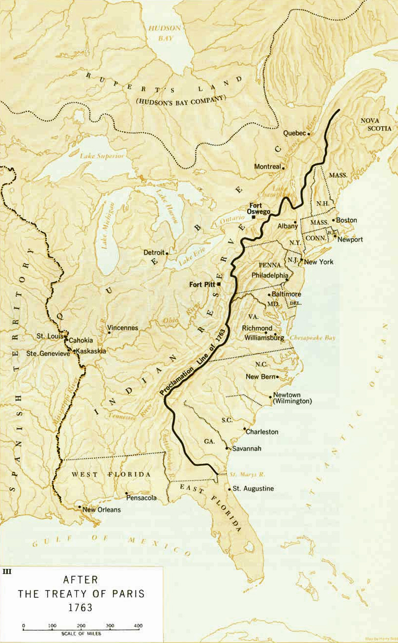
Historical Map of North America
in 1763 after the
 Treaty of Paris (February 10,
1763) and after the
 Royal Proclamation (October 7,
1763)
Illustrating
Proclamation
Line of 1763
Indian Reserve
Rupert's Land (Hudson's Bay Company)
Please note: By the Royal
Proclamation of October 1763, the northern border of West
Florida had been fixed at 31° latitude.
The
northern border of West Florida on this map (moved north from 31° to
32° 28' latitude) was in effect from June 6, 1764.
See more
 here.
here.
Credits
NPS
Related Links
 Pontiac's Rebellion
 About the Proclamation of 1763
Related Maps
 Map of Pontiac's War (all forts and battles)
 North America Until
1700
 North America to 1763

More History
 |