|
Map Description
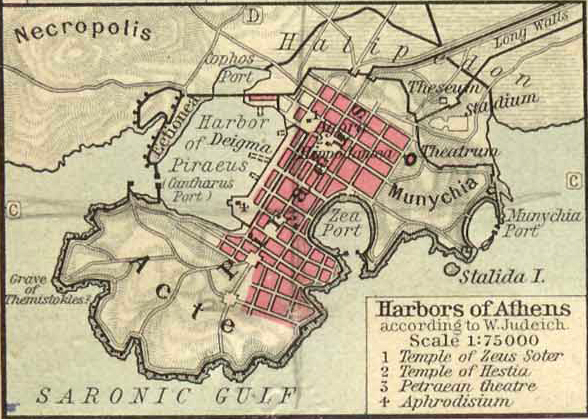
Historical map of the Harbors
of Athens, 480 BC
Harbors of Athens, according to
 Walther Judeich,
illustrating:
Walther Judeich,
illustrating:
1 Temple of Zeus Soter
2 Temple of Hestia
3 Petraean Theater
4 Aphrodisium
The
hill of Munychia, Long Walls
Credits
University of Texas at Austin.
Historical Atlas by William Shepherd (1923-26)
Related Links
About the Ancient Greeks
About the Greco-Persian Wars
About the Persian
Empire
Related Maps
Map of Athens 200 AD
Map of the Acropolis
200 AD
Map of Athens and
Piraeus
Downtown Ancient Athens
More History
 |
