|
Map Description
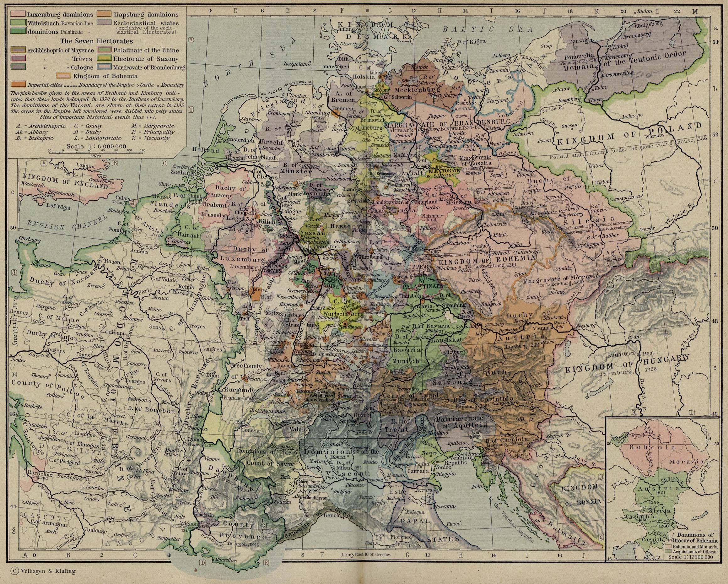
Historical Map of Central
Europe 1378
Illustrating
-
Luxemburg dominions (See also
 Luxembourg Dynasty)
- Hapsburg dominions (See also
 Habsburg Dynasty)
- Wittelsbach dominions (Bavarian Line) (See also
 House of Wittelsbach)
- Wittelsbach dominions (Palatinate Line)
- Ecclesiastical states (exclusive of the ecclesiastical
Electorates)
The Seven Electorates
Archbishopric of Mayence
Archbishopric of Treves
Archbishopric of Cologne
Palatinate of the Rhine
Electorate of Saxony
Margravate of Brandenburg
Kingdom of Bohemia
- Imperial cities
- Boundary of the Empire
- Castle
- Monastery
- Sites of important historical events
The
pink border given to the areas of Brabant and Limburg indicates
that these lands belonged in 1378 to
the Duchess of Luxemburg.
The
dominions of the Visconti are shown at their extent in 1395.
(See also
 Visconti Family)
The
areas in the Empire left uncolored were divided into petty
states.
A - Archbishopric
Ab - Abbacy
B - Bishopric
C - County
D - Duchy
L - Landgraviate
M - Margravate
P - Principality
V - Viscounty
Inset:
Dominions of
 Ottocar of Bohemia.
Illustrating
-
Bohemia and Moravia
- Acquisitions of Ottocar
Credits
University of Texas at Austin.
Historical Atlas by William Shepherd (1923-26).
Related Maps
 Map of the Dominions of Ottocar of Bohemia in
1378
 Map of France in 1377
 Map of Central Europe about 1477

More History
 |