|
Map Description
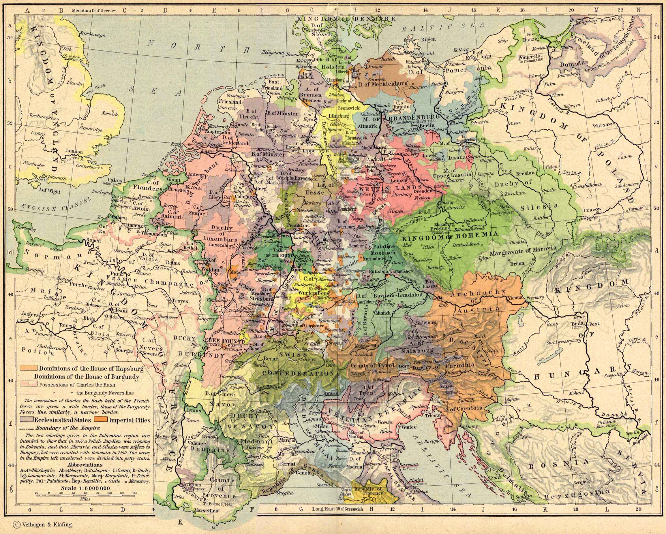
Historical Map of Central
Europe about 1477
Illustrating
-
Dominions of the House of Hapsburg (See also
 About the Habsburg Dynasty)
- Dominions of the House of Burgundy
- Possessions of Charles the Rash (See also
 Charles the Rash)
- Possessions of the Burgundy-Nevers line
The possessions of Charles the Rash held of the French Crown are
given a wide border; those of the
Burgundy-Nevers line, similarly, a narrow border.
- Ecclesiastical States
- Imperial Cities
- Boundary of the Empire
The two colorings given to the Bohemian region are intended to
show that in 1477 a Polish Jagellon
was reigning in Bohemia; and that Moravia and Silesia were
subject to Hungary, but were reunited with
Bohemia in 1490. The areas in the Empire left uncolored were
divided into petty states.
A - Archbishopric
Ab - Abbacy
B - Bishopric
C - County
D - Duchy
Lg - Landgraviate
M - Margravate
Marq - Marquisate
P - Principality
Pal - Palatinate
Rep - Republic
- Castle
- Monastery
Credits
University of Texas at Austin.
Historical Atlas by William Shepherd (1923-26).
Related Maps
 Map of Central Europe in 1378
 Map of Central Europe in 1512

More History
 |