|
Map Description
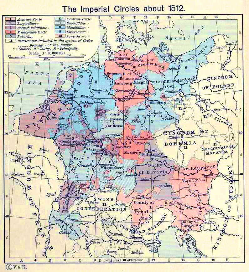
Historical Map of the Imperial
Circles about 1512.
Illustrating
1
Austrian Circle
2 Burgundian Circle
3 Rhenish Palatinate Circle
4 Franconian Circle
5 Bavarian Circle
6 Swabian Circle
7 Upper Rhine Circle
8 Westphalian Circle
9 Upper Saxon Circle
10 Lower Saxon Circle
11 Districts not included in the system of Circles
Boundary of the Empire
C - County
D - Duchy
P - Principality
Credits
University of Texas at Austin.
Historical Atlas by William Shepherd (1911).
Related Maps
 Map of Central Europe in 1378
 Map of Central Europe in 1477

More History
 |