|
Map Description
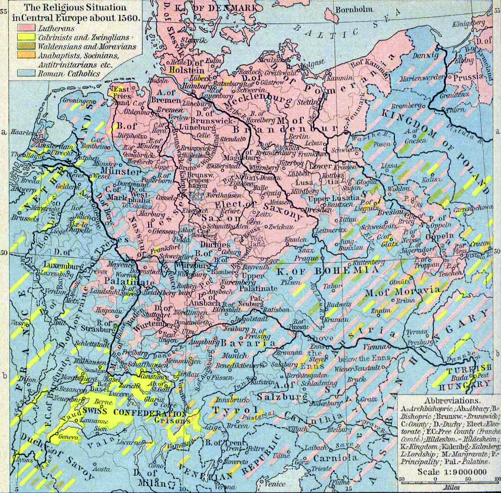
Historical Map of the Religious
Situation in Central Europe about 1560.
Illustrating
- Lutherans
 About Martin Luther
- Calvinists and Zwinglians
 About John Calvin
- Waldensians and Moravians
- Anabaptists, Socinians, Antitrinitarians etc.
- Roman Catholics
A -
Archbishopric
Ab - Abbacy
B - Bishopric
Brunsw. - Brunswick
C - County
D - Duchy
Elect - Electorate
F.C. - Free County (Franche Comte)
Hildeshm - Hildesheim
K - Kingdom
Kalenbg - Kalenberg
L - Lordship
M - Margravate
P - Principality
Pal - Palatine
Credits
University of Texas at Austin.
Historical Atlas by William Shepherd (1923-26).
Related Links
 About Elizabeth I
 About Philip II
Related Maps
 Map of Europe about
1560
 Map of Europe: Reformation to 1560
 Map of the Religious Situation in Europe about
1560
 Map of Commerce of Christendom in the 16th
Century
 Map of the Spanish Monarchy under Philip II
 Wytfliet's Map of the World 1598
 Map of Western Europe in the Time of Elizabeth

More History
 |