|
Map Description
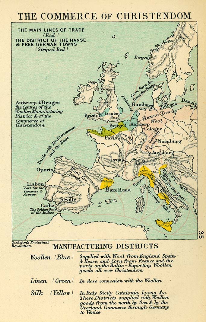
Historical Map of the Commerce
of Christendom in the 16th Century.
Illustrating
-
The main lines of trade - red
-
The district of the Hanse and free German towns - striped red
-
Antwerp and Bruges - the centers of the woolen manufacturing
district and of the
commerce of Christendom
Manufacturing Districts
Woolen - Blue
Supplied with wool from England, Spain and Hesse, and corn from
France and the ports on
the Baltic - exporting woolen goods all over Christendom
Linen - Green
In close connection with the woolen
Silk - Yellow
In Italy, Sicily, Catalonia, Lyons etc. These districts supplied
with woolen goods from the
north by Sea and by the overland commerce through Germany to
Venice
Credits
University of Texas at Austin.
From The Public Schools Historical Atlas edited by C. Colbeck, 1905.
Related Links
 About the Hanseatic League
 About Elizabeth I
 About Philip II
Related Maps
 Map of Europe about
1560
 Map of Europe: Reformation to 1560
 Map of the Religious Situation in Europe about
1560
 Map of the Religious Situation in Central
Europe about 1560
 Map of the Spanish Monarchy under Philip II
 Wytfliet's Map of the World 1598
 Map of Western Europe in the Time of Elizabeth

More History
 |