|
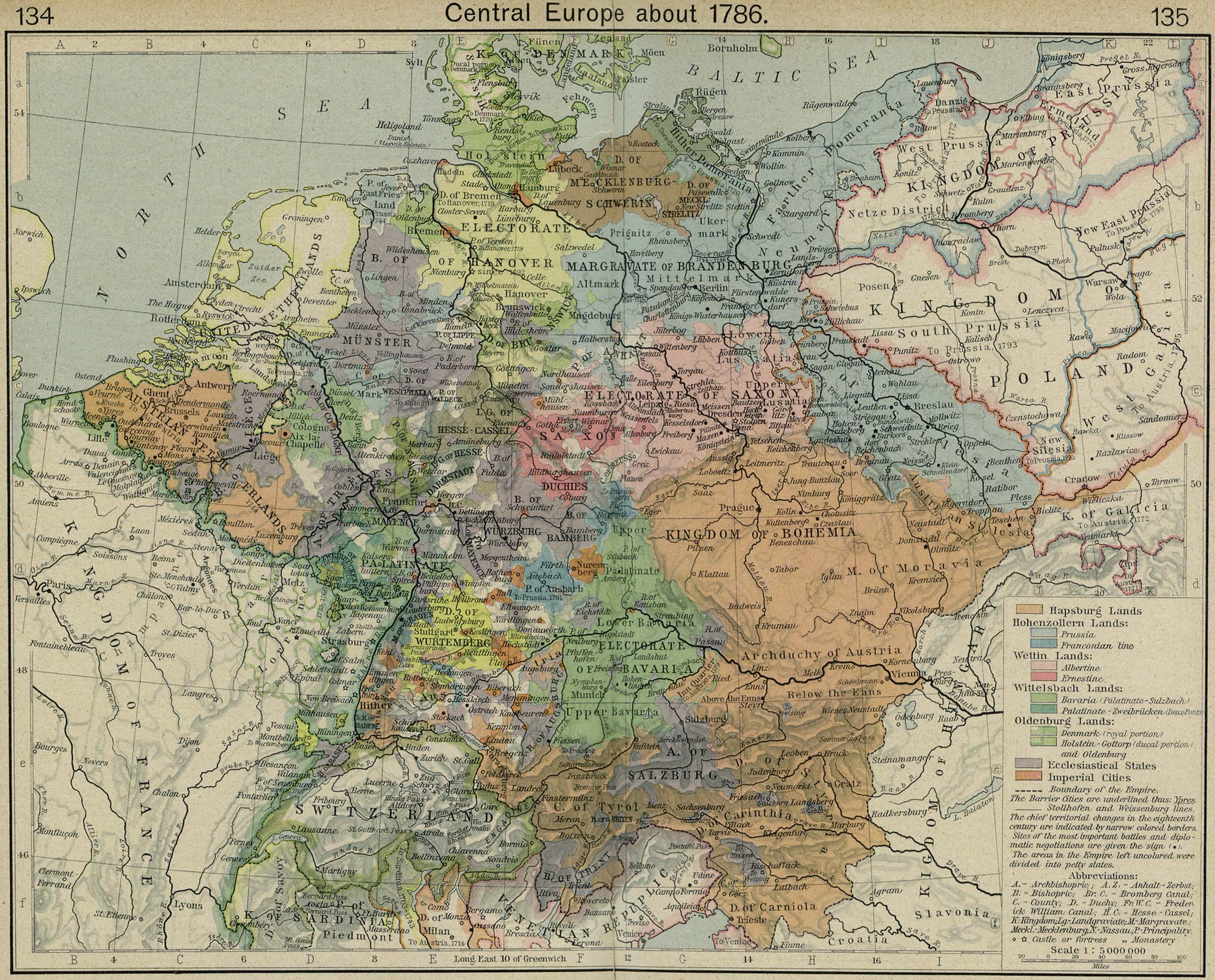
Map Description
Historical Map of Central
Europe about 1786.
Illustrating
Hapsburg Lands
 About the Habsburg Dynasty
Hohenzollern Lands:
 About the Hohenzollern Dynasty
- Prussia
- Franconian line
Wettin Lands:
 About the Wettin Dynasty
- Albertine
- Ernestine
Wittelsbach Lands:
 About the House of Wittelsbach
- Bavaria (Palatinate-Sulzbach)
- Palatinate-Zweibrucken (Deux Ponts)
Oldenburg Lands:
- Denmark (royal portion)
- Holstein-Gottorp (ducal portion) and Oldenburg
Ecclesiastical States
Imperial Cities
Boundary of the Empire
The
Barrier Cities are underlined.
- Stollhofen and Weissenburg lines.
The chief territorial changes in the eighteenth century are
indicated by narrow colored borders
Site of the most important battles and diplomatic negotiations
are given the sign (huge dot).
The areas in the Empire left uncolored were divided into petty
states.
A - Archbishopric
A.Z. - Anhalt-Zerbst
B - Bishopric
Br.C. - Bromberg Canal
C - County
D - Duchy
Fr.W.C. - Frederick William Canal
H.C. - Hesse-Cassel
K - Kingdom
Lg. - Landgraviate
M - Margravate
Meckl. - Mecklenburg
N - Nassau
P - Principality
- Castle or fortress
- Monastery
Credits
University of Texas at Austin.
Historical Atlas by William Shepherd (1923-26).
Related Links
 About the Holy Roman Empire
 About Klemens von Metternich
 About Archduke John of Austria
Related Maps
 Map of Europe in 1792
 Map of Central Europe in 1789
 Map of the Treaty Adjustments 1713-1763

More History
 |