|
Map Description
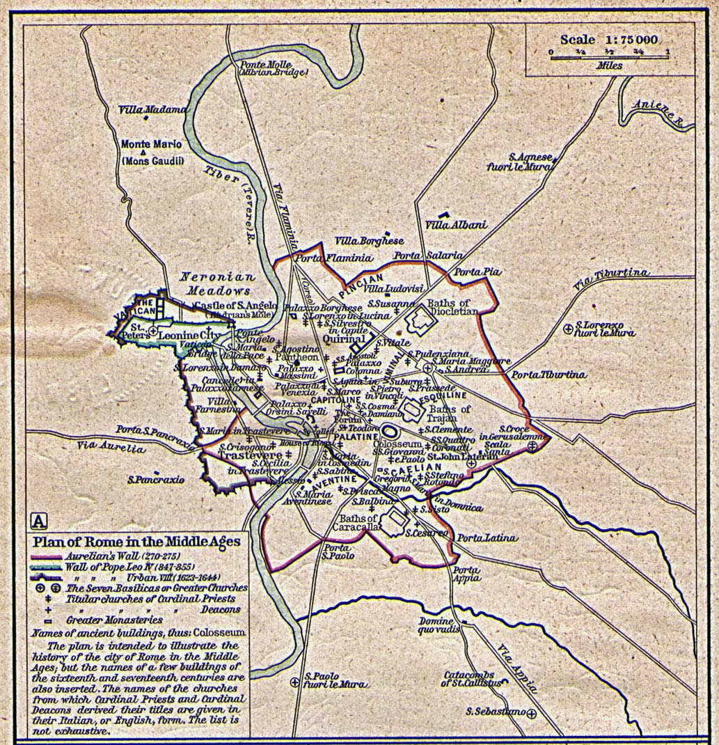
Historical map of Rome in the
Middle Ages
Illustrating
Aurelian's Wall (270-275)
Wall of Pope Leo IV (847-855)
Wall of Pope Urban VIII (1623-1644)
The Seven Basilicas or Greater Churches
Titular churches of Cardinal Priests
Titular churches of Cardinal Deacons
Greater Monasteries
Ancient buildings
The plan is intended to illustrate the history of the city of Rome
in the Middle Ages; but the
names of a few buildings of the sixteenth and seventeenth centuries
are also inserted. The
names of the churches from which Cardinal Priests and Cardinal
deacons derived their titles
are given in their Italian, or English, form. The list is not
exhaustive.
Credits
University of Texas at Austin.
Historical Atlas by William Shepherd (1923-26).
Related Links
 About Aurelian
 About Pope Leo IV
 About Pope Urban VIII
 About the Battle of the Milvian Bridge
 About Ancient Rome
Related Maps
 Map of the Forum Romanum
 Map of the Vicinity of Rome
 Map of Rome 350 AD
 Map of the Roman Bishoprics 12th Century
 Ecclesiastical Map of Western Europe in the
Middle Ages

More History
 |