|
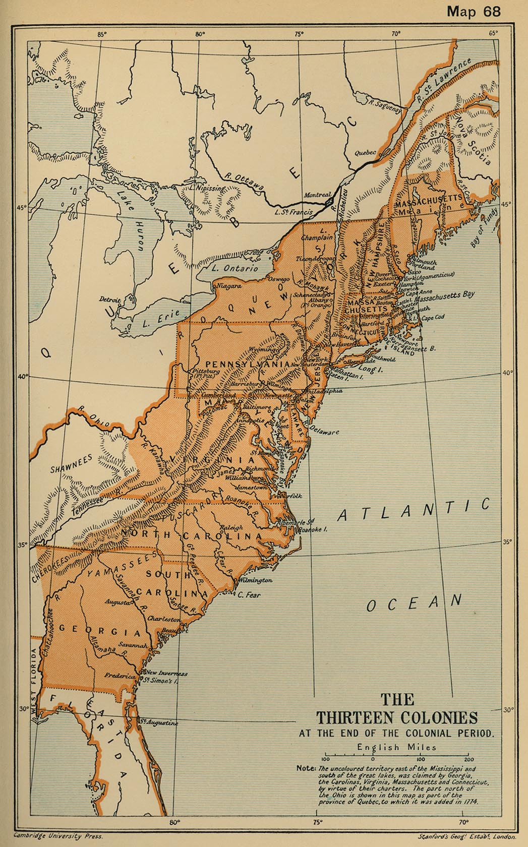
Map Description
Historical Map of the Thirteen
Colonies at the End of the Colonial Period
The uncolored territory east of the
Mississippi and south of the great lakes, was claimed
by
Georgia, the Carolinas, Virginia, Massachusetts and Connecticut, by
virtue of their
charters.
The part north of the Ohio is shown in this map as part of the
province of Quebec, to
which
it was added in 1774.
Credits
University of Texas at Austin.
From the Cambridge Modern History Atlas, 1912.
Related Links
 About the American
Revolution
Related Maps
 Map of the Middle Colonies 1607-1760
 Map of the Southern Colonies 1607-1760

More History
 |