|
Map Description
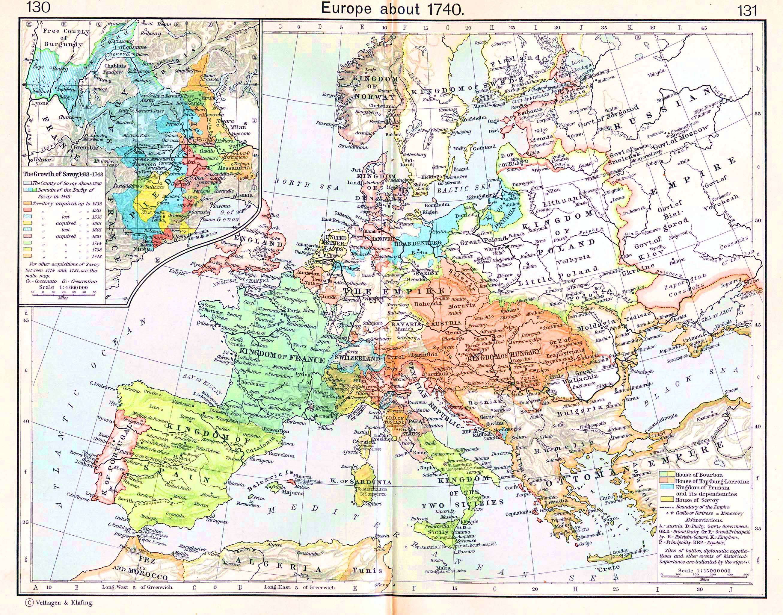
Historical Map of Europe about
1740.
Illustrating
-
 House of Bourbon
- House of Hapsburg-Lorraine (see also
 Habsburg Dynasty)
- Kingdom of Prussia and its dependencies
- House of Savoy
- Boundary of the Empire (see also
 Holy Roman Empire)
- Castle or fortress
- Monastery
A Austria
D Duchy
Govt Government
GrD Grand Duchy
GrP Grand Principality
H Holstein-Gottorp
K Kingdom
P Principality
REP Republic
- Sites of battles, diplomatic negotiations and other events of
historical importance.
Inset: The Growth of Savoy, 1418-1748.
- The
County of Savoy about 1280
- Domain of the Duchy of Savoy in 1418
- Territory acquired up to 1435
- Territory acquired up to 1531
- Territory lost up to 1536
- Territory acquired up to 1601
- Territory lost up to 1601
- Territory acquired up to 1631
- Territory acquired up to 1714
- Territory acquired up to 1738
- Territory acquired up to 1748
For other acquisitions of Savoy between 1714 and 1721, see the
main map
Co. - Cocconato
Cr. Crescentino
Credits
University of Texas at Austin.
Historical Atlas by William Shepherd (1911).
Related Links
 About Frederick II the Great
 About the War of the Austrian Succession
 About the Seven Years' War
 About the Treaty of Aix-la-Chapelle
Related Maps
 Map of Savoy 1418-1748
 Map of Savoy in 1601

More History
 |