|
Map Description
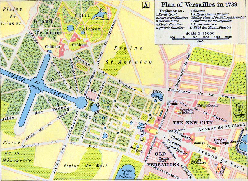
Historical Map of Versailles in
1789.
Illustrating
1
Royal Court
2 Court of the Ministers
3 Marble Court
4 King's Chamber
5 Queen's Chamber
6 Theater
7 Salle des Menus Plaisirs (Meeting place of the National
Assembly)
8 Entrance for the Deputies
9 Royal entrance
10 Hotel des Menus Plaisirs
Credits
University of Texas at Austin.
Historical Atlas by William Shepherd (1911)
Related Links
 About the French Revolution
 About the French Revolutionary Wars
 Taxation in Pre-Revolutionary France
 List of French comptrollers-general
Related Maps
 Map of the Vicinity of Paris 1562

More History
 |